Translate

Showing posts with label matzevah. Show all posts

Monday, November 8, 2021

The Enigma of Ai

Many have searched for the elusive ancient city of Ai, but so far no suitable candidate has gained comprehensive support from archaeology and biblical scholars. However, one recently discovered location has been missed, not spoken of very much and not identified with any other previous locations. Uncannily, it was excavated in 2008/9 simultaneous with the the rock-cut-rooms on the eastern slope of Mount Moriah, 1.3 kilometers to the west.

East of Beit El, West of Ai

To resolve confusion, the image above satisfies each of the five places, in the Bible that link Bethel and Ai. For the correct archaeological site to be identified, each description must conform to the precise physical location.

a. Abraham’s tent: "From there he moved on to the hill east of Bethel and pitched his tent, with Bethel on the west and Ai on the east; and he built there an altar to the Lord and invoked the Lord by name." (Genesis 12:1-8)
          
And he returned by stages from the Negev as far as Bethel, to the place where his tent had been formerly, between Bethel and Ai, the site of the altar that he had built there at first; and there Abram invoked the Lord by name. (Genesis 13:3-4)

b. The conquest of Ai: “Joshua sent men from Jericho to Ai, which lies close to Beth-aven – east of Bethel” (Joshua 7:2). Joshua set an ambush of thirty thousand warriors, followed by a second ambush of five thousand, strategically placed “between Bethel and Ai – west of Ai.” When Joshua and his men feigned retreat, the armies of both cities pursued their Israelite foes, leaving the cities defenseless against the hidden ambush: “Not a man was left in Ai or in Bethel who did not go out after Israel; they left the city open while they pursued Israel” (Joshua 8:17).

c. The 31 Canaanite kings: One of the kings listed is “the king of Ai, near Bethel” (Joshua 12:8).

d. The returnees from exile (in Zerubbabel’s time): ...of those “who returned to Jerusalem and Judah, each to his own city” (Ezra 2:1; Nehemiah 7:6), the returnees are organized by point of origin. There we find: “The men of Bethel and Ai – 223” (Ezra 2:28; in Nehemiah 7:32 the number is given as 123).

e. The final listing of the people of Israel: “The Benjaminites: from Geba, Michmash, Aija [Ai] and Bethel and its outlying towns” (Nehemiah 11:31).

In each of the above cases the excavation at Ras al-Amud fits the correct location, time period and scale for the missing city of Ai. 

City of Ai at Ras Al Amud, finally located


In the rectangle original Beit El before the walled city.
Approximately 800m west of Ai
Boundary - Benjamin (north) and Judah (south).

The hypothesis for original Beit El is strengthened by archeological findings and carbon dating. Details in the video below.


Sunday, November 7, 2021

“Jacob Gave The Name Beit El To Jerusalem”


Click to enlarge

בראשית כ״ח:י״א

(יא) וַיִּפְגַּ֨ע בַּמָּק֜וֹם וַיָּ֤לֶן שָׁם֙ כִּי־בָ֣א הַשֶּׁ֔מֶשׁ וַיִּקַּח֙ מֵאַבְנֵ֣י הַמָּק֔וֹם וַיָּ֖שֶׂם מְרַֽאֲשֹׁתָ֑יו וַיִּשְׁכַּ֖ב בַּמָּק֥וֹם הַהֽוּא׃
Genesis 28:11
(11) He came upon a certain place and stopped there for the night, for the sun had set. Taking one of the stones of that place, he put it under his head and lay down in that place.

Rashi verbatim

THIS IS NONE OTHER THAN THE HOUSE OF GOD —R. Eleazar said in the name of R. José the son of Zimra: “This ladder stood in Beersheba and [the middle of]) its slope reached opposite the Temple” (Genesis Rabbah 69:7). For Beersheba is situated in the South of Judah, Jerusalem in the North of it on the boundary between Judah and Benjamin and Bethel in the North of Benjamin’s territory, on the border between the land of Benjamin and that of the children of Joseph. It follows, therefore, that a ladder whose foot is in Beersheba and whose top is in Bethel has the middle of its slope reaching opposite Jerusalem. 

Now as regards what our Rabbis stated (Chullin 91b) that the Holy One, blessed be He, said, “This righteous man has came to the place where I dwell (i.e., the Temple at Jerusalem, whilst from here it is evident that he had come to Luz) and shall he depart without staying here over night?”, and with regard to what they also said, (Pesachim 88a) “Jacob gave the name Bethel to Jerusalem”, whereas this place which he called Bethel was Luz and not Jerusalem, whence did they learn to make this statement (which implies that Luz is identical with Jerusalem)? 

I say that Mount Moriah was forcibly removed from its locality and came hither (to Luz), and that this is what is meant by the “shrinking” of the ground that is mentioned in the Treatise (Chullin 91b) — that the site of the Temple came towards him (Jacob) as far as Bethel and this too is what is meant by ויפגע במקום, “he lighted upon the place” (i.e., he “met” the place, as two people meet who are moving towards each other; cf. Rashi on Genesis 5:11). Now, since Jacob’s route must have been from Beersheba to Jerusalem and thence to Luz and Haran and consequently when he reached Luz he had passed Jerusalem, if you should ask, “When Jacob passed the Temple why did He not make him stop there?” — If it never entered his mind to pray at the spot where his fathers had prayed should Heaven force him to stop there to do so? Really he had reached as far as Haran as we say in the Chapter גיד הנשה (Chullin 91b), and Scripture itself proves this since it states, “And he went to Haran”. When he arrived at Haran he said, “Is it possible that I have passed the place where my fathers prayed without myself praying there?” He decided to return and got as far as Bethel where the ground "shrank” for him. This Bethel is not the Bethel that is near Ai (cf. Genesis 12:8) but that which is near Jerusalem, and because he said of it, “It shall be the House of God”, he called it Bethel. This, too, is Mount Moriah, where Abraham prayed, and it is also the field in which Isaac offered prayer as it is written, “[Isaac went out] to meditate (i. e., to pray; cf. Genesis 24:63) in the field”.

Thus, too, do we read in the Treatise (Pesachim 88a) in a comment on the verse Micah 4:2: “[O come ye and let us go up] to the mountain of the Lord (i.e. the mountain upon which the Temple is built) and to the house of the God of Jacob”. What particular reason is there for mentioning Jacob? But the text calls the Temple not as Abraham did who called it a mount, and not as Isaac did, who called it a field, but as Jacob did who called it Beth[el]—the House of God. (To here from “This Bethel” is to be found in a certain correct Rashi-text)

Tuesday, October 12, 2021

Beit El, Jerusalem - Did King David Know?

For 10+ years I patiently waited for news, finally it came. Using carbon dating on seeds, twigs and dirt, Regev et al unambiguously showed that the Rock-Cut-Rooms, on the eastern slope of Mount Moriah are sandwiched between two sources of evidence dated to the Middle Bronze Age approximately 3500 and 3800 years ago.

Bronze Age Rock-Cut-Rooms

This is important because all archaeological evidence on the bedrock of these rooms was removed in the Iron Age II, around 2600 years ago when builders for King Hezekiah constructed the recently discovered eastern city wall (W20005 - W20021). Based on this evidence, before the rooms were first uncovered 2600 years ago they lay buried, out of use for some 900 years. No evidence of this time-frame showed up in the carbon dating report. 

Area U and Rock-cut Rooms
 (V. Essman and O. Rose)
Approximate evidence locations marked in red.

You following this? These rooms were in use up till 3500 years ago, then they stopped being used for 900 years, then 2600 years ago they were discovered, uncovered and immediately buried, finally they were re-discovered and uncovered again in 2011. 

East-side evidence samples

West-side evidence samples

Stunningly, the flimsy matzevah at the west end of room 4 (Area U map above) was intact as far back as 3600 years ago, the time of biblical Jacob. This perfectly fits the time-frame of evidence discovered on both sides of the rock-cut-rooms. Further, as the evidence stretches back to 3700 or 3800 years it suggests the rooms were actively in use at that time.

Matzevah (Pillar) of Jacob?


Eli Shukron, the archaeologist who excavated these rooms is unequivocal, this is the first temple that ever existed on Mount Moriah, a thousand years before the First Temple of King Solomon. If this is the matzevah of Jacob (Genesis 28:18, 28:22, 31:13, 31:45, 35:14, 35:20), then this is also the Beit El where Abraham built an altar, tithed to Malchi-Tzedek and offered his son, Isaac. Could it be?


Context to slope of original passage (Parker XVIII)
between Gihon Spring and rock-cut-rooms


Tuesday, August 10, 2021

Jerusalem Archaeology A Biblical Narrative?

Jerusalem's defensive wall on the steep eastern slope

The late first temple city wall, discovered on the lower eastern slope of Mount Moriah exposes the strategy that once revived use, from 1000 years prior, of a Bronze Age underground passage - Warrens Shaft System (WSS) to deliver water inside (west) of the wall so that the city could prolong its siege defense against Assyrians and Babylonian enemies. 

https://www.youtube.com/watch?v=Z5Wqhf_8itA 

The mountain city's natural water source was the Gihon Spring, in the eastern escarpment where water exited into a cave just above the valley floor. For the first Bronze Age residents, living on the upper ridge, moving water 60 vertical meters up the escarpment was a major daily undertaking. Back then, supply was regulated by the local kings' whose water carriers would haul water sacks up the escarpment to meet the growing demand further up the ridge.

The east, west and south escarpments, on lower Mount Moriah fall sharply into surrounding valleys that provided a naturally defensive barrier against enemy attack. From the north, on the summit, distant movements could be clearly observed to prepare and repel hostilities. The upper flats, on the lower section of Mount Moriah was ideal to establish a small village and protect its residents, but water presented a major challenge.

Bronze Age occupants had a limited population size, but archaeology for that period suggests more than just local residents helped to construct a secure water carriage system. According to the Hebrew Bible Mount Moriah contained indigenous artifacts that Israelites, after Jacob and 250 years of exile, would have been intent to reclaim along with their inherited land. To improve water security and possibly dissuade an Israelite attack, the residents must have obtained regional labor support from regional allies in order to massively excavate the bedrock of the mountain.

Four significant constructions must be understood in order to interpret ancient events on the mountain and the motivation for theses constructions:

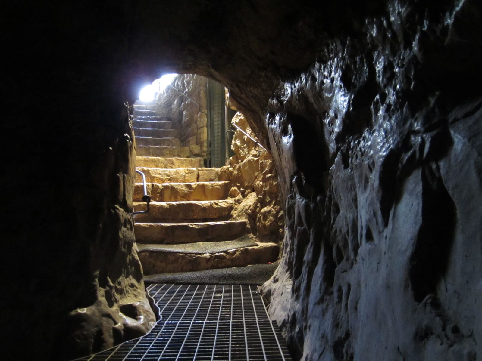
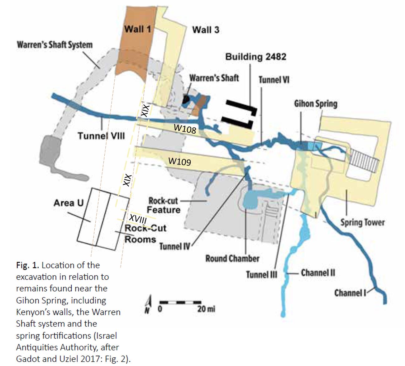
1. The 'Warren's Shaft System' (WSS) - a man-made tunnel rising through the mountain that permitted cool, efficient and protected passage to water carriers. Water was carried from the spring, hauled up to lower level dwellings at the uppermost exit of the system and further up to the city's mountain ridge (a ~60m vertical rise from the water).  

2. Double walls - 'W108/W109' were built, east-west up the escarpment using +1 ton boulders carried up a ~30 degree grade and precisely placed to build the staggered walls that stretch ~50 meters uphill at a height of 6-10m. Such a substantial construction required more labor force than the residential capacity of the upper city.

3. The 'Rock-cut Feature' (RCF) - a large quarry, south of W109 left a gaping wound in the bedrock and cut convenient access between Area U's Rock-Cut-Rooms, on the higher slope of the eastern escarpment and the Gihon water source below.


4. The 'Rock-Cut-Rooms' (RCR) - a temple complex of 4 rooms each with a feature dedicated to worship. They include (from north to south) an olive press for pure oil, raised altar platform and liquids channel, matzevah or anointing-pillar and room for slaughtering and processing animal sacrifices. 


Ongoing debate about the date of these features leads to consensus that some or all elements, of each feature converge on periods of the Bronze Age, which is sufficient context for this article. 


The time-layered system of channels, walls, boulevards, ridges and passages secured water supply for residents who had moved from the valley floor to the mountain ridge. It also served the franchise of the local king. 

During the Bronze and early Iron Age produce in the Kidron Valley was grown using the constant flow of water from Channel I or II. At or around the Gihon Spring produce was processed, traded and distributed. There produce and water filled leather sacks would have been loaded on donkey's that traversed up the escarpment into the city. Eventually a walkway and donkey pathway (see image below) eased the 35+ degree climb ~60 vertical meters up the eastern slope. Food trade from other cities, including the coast may also have arrived from the north and west, along convenient routes to the Kidron Valley.  

South to the Kidron Valley - winding walkway and donkey path (green)
built on terraces (foreground) and Kings Garden (background).

Terraces supporting pathway
 looking north

When attacked the terraced path became exposed and water transportation retreated underground to the excavated WSS. Water carriers would carry water sacks through its underground tunnel and haul them up its vertical shaft to a height ~40m above the Gihon Spring, more than halfway to the top of the donkey trail. At that height, out of harms way carriers would exit a narrow tunnel and carry water the rest of the way into the city.

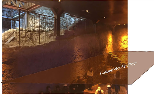
A natural cave, dated to paleolithic and chalcolithic periods was the original entrance to natural caustic WSS formation. The cave (pictured below), just west of Building 2482 was eventually sealed with a wall, most likely when W108 and 109 were constructed to further secure access to the expanded WSS. The floor of the cave eventually collapsed. Interestingly a recent finding confirmed a massive earthquake late in the Iron Age, which may have been the cause of the floor collapse. 

Archaeologist Ronny Reich inside
the sealed cave leading into WSS to his right

The elevated city provided defensive advantage, especially for prolonged sieges that typically surrounded a city or attacked the water and produce supply line to starve its population and flush them out. For Bronze Age Jerusalem that supply line was at or around the Gihon Spring, the route up the eastern escarpment and the exposed entry to the city from the north. Any enemy force that could prevent food supply would essentially starve the city except for the life-line of water via WSS.

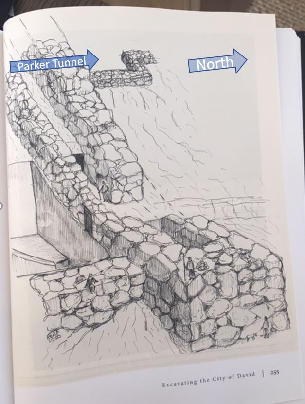
The remnant of the recently discovered late Iron Age wall, built by Hezekiah to stave off  the Assyrian threat was constructed on a line that entirely ran over the RCR's. Archaeologists validated this 200 meters stretch of wall, on the eastern escarpment as Jerusalem's only defensive city wall, none has been discovered on the west. 

Under the wall, on the RCR bedrock of room 2 (see RCR image above) a matzevah (discovered by Eli Shukron 2009) had been entirely preserved in soft sand by the constructors of the wall. The matzevah is the modern City of David's largest, in-situ, intact artifact that has survived earthquake and destruction, because the wall surrounded and protected it. This is strong indication that the King, who constructed the wall, most likely Hezekiah ordered preservation of the matzevah because it reflected his compatible belief in line with that of Azariah, the High Priest and Isaiah, the prophet of the nation at that time. 

The RCR's form a temple complex that includes a sacrificial altar platform at the west end. Priests offering a sacrifice on the altar, that once stood on the platform, had to turn their backs to the sun an unlikely orientation for sun god worshippers, but consistent with practices of monotheistic tradition preceding and incorporated by Judaism. Further, bored into the leading edge of the north wall rock-face, in the room 1 (with V markings in the floor) small animals were tethered. This is evidenced by the low bedrock pass-through-loop that signifies more frequent sacrifice of small animals. According to Jewish law, animals offered for sacrifice must be blemish free and more than 8 days old, naturally younger animals were certain to remain blemish free.  

Low animal tether
 looped in bedrock edge
Close up of low animal
 tether ~25cm above ground

None of the indications in the RCR bedrock inform of its earliest use. However, if this temple complex was indeed used by priests who practiced what would become Jewish custom, then the matzevah is problematic because the Jewish Bible prohibited such use. This can be seen in the words of Deuteronomy 16 below:

21 לֹֽא־תִטַּ֥ע לְךָ֛ אֲשֵׁרָ֖ה כׇּל־עֵ֑ץ אֵ֗צֶל מִזְבַּ֛ח יְהֹוָ֥ה אֱלֹהֶ֖יךָ אֲשֶׁ֥ר תַּעֲשֶׂה־לָּֽךְ׃
You shall not set up a sacred post—any kind of pole beside the altar of the LORD your God that you may make—
22 וְלֹֽא־תָקִ֥ים לְךָ֖ מַצֵּבָ֑ה אֲשֶׁ֥ר שָׂנֵ֖א יְהֹוָ֥ה אֱלֹהֶֽיךָ׃         
or erect a stone pillar (matzevah); for such the LORD your God detests.

However, in an apparent contradiction (Genesis 28:18-22), some 270 years before Biblical laws were collectively accepted by the Israelite nation, Jacob erected and anointed a matzevah to mark his covenant. Naturally the question must be asked; whether a matzevah at this compatibly Jewish, cultic RCR temple complex should indicate an early use based solely on this Biblical prohibition from the end of the Middle Bronze Age?

The original path from water to RCR's was discovered and mapped by Parker-Vincent, but the east end of passage XVIII (see below) had been quarried, disconnecting it from or to the lower section of bedrock. Topology of in-tact bedrock, north and south suggests XVIII would have sloped similarly. Thus, we can conclude that before the Rock-Cut-Feature (RCF) was quarried and emptied, its once untouched bedrock provided uninterrupted egress to and from the Gihon Spring or steps to the Round Chamber and Channel II filled it to a maximum depth of around 1m.

Visitors climb up XVIII to RCR's
the down path leads to water

Map inserted below for convenient reference. 

Height's shown are above sea level

The Bronze Age consensus for W108-W109 construction and presumption that the RCF was the quarry for these massive walls suggests RCF was in-tact until at least these constructions. Therefore, when passage XVIII collapsed or was cut, at its eastern end temple worship on or at the RCR's ceased because once W108-W109 and Wall 3 were constructed access along passage XIX was also blocked. The combination of these terminated passages sealed the fate for any practical future use of RCR's as a temple for worship.

Archaeological evidence suggests the Bronze Age population averaged no more than 800 people, and Late Bronze Age Jerusalem appears to be even smaller. At a maximum the population would have been around 1250 people living on the ridge of Mount Moriah. It's hard to imagine, given the massive scale of these complex constructions that such a small population could have independently supported these undertakings. Further, limited Late Bronze Age evidence suggests the population diminished, perhaps after initial construction was completed. 

The most intriguing and complete evidence from the Late Bronze Age, found in the Amarna letters suggests Egypt's hand in the affairs of 'Urusalim', which prompted Steiner to write in 2003 (abridged):

“Realizing that Urusalim from the Amarna letters must be associated with Jerusalem, I began to read  carefully and discovered another possibility that might account for the lack of archaeological evidence from the fourteenth century. There is no reference to the city itself, nor to its walls or its strong gates. Maybe Urusalim was not a city or large town at all. Maybe we should interpret the “lands of Urusalim” as a royal dominion of the pharaoh, with Abdi-heba as his steward, who lived in a fortified house somewhere near the spring.” 

Perhaps we are left to imagine that Canaanite or Jebusite anxiety, after Israel departed Egypt prompted pharaoh to transform the landscape of the Gihon spring. W108-109 divided the eastern slope, secured entry to WSS and with Wall 3 cut access via XIX to RCR's. To add insult the pharaoh cut the ancient access passage via XVIII and the RCF left a gaping, impassable hole in the bedrock.

The layered time context of the archaeological evidence paints a picture of cave dwellers, early farmers, community, cultic practice, organized supply, defensive activity, and centralized authority. Leading to the end of the Middle Bronze Age's sophisticated construction, bedrock transformation and population expansion. Then, in the Late Bronze Age population downsizing, limited advancement and vassal  acknowledgement until the arrival of the Iron Age when renovation, expansion and development into the City of David recommence with vigor.  

If Israel had become Egypt's spiritual nemesis, transformation of the Gihon Spring had the desired effect. After returning from their 250 year exile in Egypt Israel were kept out of Jerusalem for more than 300 years, until the Iron Age. By then the RCR temple was most likely buried and unknown to the mountain residents and certainly to the generations of Israelites. By the time King David conquered the tower of Zion, the spring citadel and captured the defensive water supply tzinor or "pipe" (WSS) the RCR temple was long forgotten. Perhaps The constructor's of Hezekiah's terminal Iron Age wall were the first, in more than 1000 years to reveal the ancient bedrock RCR temple that pre-dated the Jewish religion on the eastern face of Mount Moriah.

Monday, November 9, 2020

Israel's Greatest Archaeological Treasure

Jerusalem's' Gihon Spring emerges in an elevated cave  approximately 4 meters above the Kidron Valley floor. Originally the cave would fill with gushing water, rising several meters until it reached the opening on the eastern side of the mountain. 

Gihon Spring Cave - Looking East

Water flowed from the cave, falling to the east side of Mount Moriah, onto the lower valley floor, where it ran south-east along an eight kilometer downhill slope that dropped ~1000m to the Dead Sea. 

Gihon Spring, Mount Moriah 

Kidron River Route City of David, Jerusalem to Dead Sea

Archaeologists agree that during the Early to Middle Bronze Age a man-made opening, some 2 meters above the spring source was cut into the south-side bedrock, of the water filled cave, to redirect water through 'Channel I' and 'Channel II' until it exited onto agricultural terraces, on the east side along that route. (see map below)

Channel II also distributed water to Tunnel III and a deep-cut 'Round Chamber' that probably existed prior to the channel-tunnel constructions or was quarried around the same time. The 'Round Chamber' served as a well that dropped ~3m from the bedrock surface to access water provided, via Tunnel III, from the surface. For at least 1000 years water flowed through Tunnel III into the Round Chamber and further south, via Channel II exiting the east face through agricultural terraces to the valley floor bellow.


Prior to construction of the channel-tunnel system the Round Chamber may have existed as the shaft to an Early Bronze Age shaft-tomb into which Tunnel III was cut or was was constructed to improve access to the water. The steps, depicted on the map above (right or east of the Round Chamber) demonstrate that improved access to the water was their purpose. On completion, water would have been drawn from two primary points; 1) steps into the cave of the Gihon Spring; 2) steps to the Round Chamber well as well as points along the southern extension of Channel II, as water exited the bedrock further down the mountain. 

During the Early-Middle Bronze Age the Rock-Cut-Rooms, adjacent to Area U (see map - west) served as a temple, the first organized worship on Mount Moriah. Archaeologists widely acknowledge the Rock-Cut-Rooms existed and were in use more than 3600 years ago. Eli Shukron, the archaeologist who made the discovery in 2009 attributes them to Biblical Malchi-Tzedek, the Righteous King who, according to the Bible practiced as the high priest at this location until he died around 3600 years ago.

Intriguingly most of the features of the Rock-Cut-Rooms resemble elements that were ultimately written into Biblical, Israelite and Jewish law some 300-500 years later. These laws governed and gave a design, based on ancient ritual, to the the portable Sanctuary built and used in the desert after the Israelites were exiled from Egypt.

Rock-Cut-Rooms, adjacent-east of Area U

A uniquely preserved feature of the Rock-Cut-Rooms is a standing stone, referenced in the Bible as a 'matzevah' that was later disallowed following the introduction of Biblical law (Deuteronomy16:21-22). Initially the Bible tells of a standing stone erected (Genesis 28:18) by the progenitor of the Israelite nation, Jacob. Most commentators attribute its location to Mount Moriah where ~200 years before Moses transcribed the Bible Jacob had returned (Genesis 35:14). Jacob had used the matzevah as an instrument of worship to declare his "House of God" covenant, but later the practice was specifically forbidden by the Bible law of Moses.

I am a proponent that the Rock-Cut-Rooms are the site Jacob erected his matzevah because  chronological elements align facts with Jewish traditions and laws. Israel possesses no other archaeological sites that incorporate the qualifying features of the Rock-Cut-Room temple, according to well known Jewish temple law. These laws support the altars' raised platform, at the west of the room where priests would have faced west. In addition, the liquids channel (wine/water/blood), non-production oil press (single press only for purity) and bedrock-grain press. Further, in front of the altar  platform there is a deep concave in the bedrock designed to insert a convex, rounded jug (as opposed to a self-standing jug) which was used to prevent sacrificial blood from congealing and ensure its purity.

Altar platform, liquids channel vessel holder

Bored through the bedrock edges, adjacent to the 'V' marked bedrock are a series of places to tie small animals, indicating use of primarily young animals for slaughter and sacrifice. Jewish law requires unblemished animals, which tend younger from at least 8 days old. 

Bored low for small animal ties.


Finally the matzevah is the only erect object of the Rock-Cut-Rooms that has remarkably existed in-tact for 3500+ years.

Undoubtedly, thousands of sacrifices were offered over hundreds of years of worship at the temple of Rock-Cut-Rooms. Water was required to wash and process animals and their hides, as such water carriers would have transported it in vessels up the steep slope from the Round Chamber each day.  


(If your mobile device blocks the video at the Rock-Cut-Rooms click - https://youtu.be/CRhiq0FpLqE)

The Rock-Cut-Rooms had previously been buried, under natural fall from the slope, some 500 years before King David arrived to unite his tribal kingdom and live on Mount Moriah. The rooms had been buried sometime between 3600 and 2900 years ago, almost certainly King David did not know of their existence. Some 1000 years later, builders were the first to rediscover them, 2600 years ago, during the construction of defensive walls along the eastern slope. Archaeologists acknowledge that the fragile matzevah was purposely preserved, in soft sand, most likely by King Hezekiah's wall constructors before they completed the wall over the Rock-Cut-Rooms. In 2009 archaeologist Eli Shukron re-discovered it within the fill of Ancient Jerusalem's thick eastern wall in a well protected, 2600 year preserved state.


Matzevah, anointing pillar or standing stone

After the Five Books of the Bible (Old Testament) came the Book of Judges, the Books of Samuel, Books of Kings, Prophets and later books, but there is no mention or hint of the rock-cut Temple complex. One of the greatest Biblical commentators, Rabbi Moses Maimonides was once asked why the Bible did not mention Jerusalem; he wrote that Israel's enemies would have been emboldened to destroy it forever. Perhaps the rock-cut temple's burial was natural or an attempt to conceal its existence forever and Jerusalem's 2600 years old walls its' ultimate defense against its destruction. Either way, now that the rock-cut temple is in Israel's safe hands we must ask whether the matzevah is that on which Jacob accepted his nations name Israel (Genesis 35:10) and therefore declare it Israel's greatest and holiest archaeological treasure.


Thursday, September 17, 2020

Unifying The Archaeology of Ancient Jerusalem

Multiple theories attempt to explain the complex findings at the Gihon Spring on the eastern slope of Mount Moriah's City of David, the original Jerusalem. Ortal Chalaf, previous lead archaeologist recently wrote about the Iron Age discoveries he excavated. As interesting as that is, this article starts at least 2000 years prior. Controversy abounds about events on the bedrock especially over the first constructions, so I thought it may be useful to learn about this.

Caves on the eastern slope, immediately above the valley floor at the Gihon Spring (@634m above sea level) offered a glimpse into the first paleolithic through calcholithic residents on the mountain. In 2008 an opening to the cave was found, concealed by a fortified passage filled with rocks containing middle Bronze Age debris. Was the fill part of the original construction or was it dumped at a later stage?

Adjacent to and north of the first cave, above Warrens Shaft another opening to a second cave. Along the north-south running eastern face the bedrock falls 2-3 meters supporting these large cave entrances. The sheer drop of the geophysical eastern face may have been the direct result of the cavernous spaces that once formed behind the rock face. However slightly further south the rock face seems to have been cut or quarried.

Eli Shukron stands at the cave entrance (@645m) in the
fortified passage between wall 109 (left) and 108 

Lower and upper floor (@640m) and Warrens Shaft (lower
 right) that leads down to the floor below (@635m)

The original residents of these caves were elevated @645m and had limitless access to water from the Gihon Spring. However, growing a population in the caves was restricted by their small size. Further up the hill important people were entombed during the early bronze age and sophisticated artifacts were found in the burial caves @685m. The archaeology of all these caves and the first man-made structures does not suggest a large urban center, rather a small enclave and leaders with a degree of regional importance.

Sophisticated Early Bronze pottery from burial caves

Toward the end of the early Bronze Age the population on and around the mountain began to expand and the archaeology changed. The first break-away's may have lived on the lower valley floor around the Gihon Spring, but most of the growth was supported in caves and rudimentary building constructions, further south along the water line that followed the natural downhill slope of the Kidron valley. In any event there is little evidence of significant population expansion until the Middle Bronze Age from which time the archaeology begins to differentiate.

Ronnie Reich on the upper floor (@645m) of the entrance to
the cave  that was blocked above Warrens Shaft 

The fortified passage, built between walls 108-109 may have originally been filled, as it was when discovered with Middle Bronze age debris that blocked the cave entrance to support a walkway to a temple complex built of rock-cut-rooms. Alternatively fill was dumped into the passage at a later date in which case the purpose of walls 108-109 was to shield entrance into the cave and Warrens Shaft System. The rock-wall that blocked entrance to the second cave, immediately above Warrens Shaft was built to block entry to the Warrens Shaft System, but not necessarily constructed simultaneous with walls 108 and 109. 


Gray color denotes structures in or below bedrock


Whether the fortified passage was filled or open, between walls 108-109 the rock-cut-rooms, adjacent to and below Area U (see map above) along passage XIX or via XVIII were the obvious destination. But, why such a massive building scale for the small local population? The temple complex built on the bedrock of the rock-cut-rooms is a significant structure and may answer this question.

Rock-cut-room temple complex

Unlike other cult sites in Israel the features of the rock-cut-rooms are very “Jewish”. By its design, priests would have to face the west, facing toward the altar platform, their backs to the sun while offering sacrifices. The altar platform terminates on the southeast corner (highly specific to Jewish mystical tradition) into a liquids channel, adjacent to a matzevah, oil press, grain press, animal pen and restraints. It's not so unusual that a Middle Bronze Age temple, one that preceded the Jewish nation under Moses could have Jewish characteristics. Religious scholars acknowledge documented practices included in the Bible that predated Moses, including the use of a matzevah, which was specifically disqualified by Moses toward the end of the Late Bronze Age.

A significant event that prompted construction of the rock-cut-room temple complex may explain why it was developed as well as the minimal archaeology on the mountain and areas surrounding the Gihon Spring. The temple complex must have originally been motivated by a spiritual heritage, an event or legendary figure that led to construction especially of the significant Middle Bronze Age walls 108-109. This expanding religious site, as the centerpiece of Mount Moriah during the Early and Middle Bronze Ages may be better explained by a small, priestly or religious residency and their archaeological remnant of this extended period.

On the mountain , the cultural heritage of ancient descendants who predated the Jewish nation would also support the actions of King David, as described in the Bible. After 7 years as king in Hebron, David felt sufficiently compelled to raid the Gihon Spring, enter Zion and move his kingdom to Jerusalem, on Mount Moriah. We are told the raid was via a "tzinor", a narrow pipe likely to have been Warrens Shaft. At that time the Warrens Shaft System was the main tunnel route for water transport into the city. Once David controlled that route, residents and their leaders were beholden to him. By the time David settled, well into  the Iron Age religious worship at the rock-cut-temple may have already been abandoned, bedrock buried by debris and no remaining sign of his ancestral origins on the mountain. The rock-cut-rooms were next seen during the reign of King Hezekiah several hundred years later and are presently the subject of intense excavation by the Israel Antiquity Authority.  


Thursday, August 20, 2020

Good god it was gad!

The annals of ancient civilizations demonstrate the influential power of stellar patterns used to predict good fortune and events that challenged early creation logic. Against ethereal alternatives the constellation logic of occultists, soothsayers and stargazers prevailed. Perhaps the seemingly abstract, often ambiguous and sometime falsified prophetic voice was not as consistent as the suns rising. Strong evidence of astrological cultures are found in archaeology of Mesopotamia and many other regions including in tombs of Egyptian Pharaohs that often tell of a soul journey to the stars and some that become stars. 

According to monotheism the Knower is the Knowledge and the Known, which contradicts that any intermediary, object or living god-figure could ever claim an independent role. Ancient civilizations that credited deities with independence defended the existence of pluralism. These conflicts underpinned the clash of cultures in the fertile crescent from modern Turkey through Egypt. 

Long memory is best preserved in ancient teachings and living, intact cultures that claim a communal continuum. The best long memories are maintained by cultures that posses a rich archaeology, history and anthropological synchronization in laws and customs still evident in the modern continuum.  

The oldest and most intact continuum with a written history, rich archaeology and anthropological synchronicity are the Israelite Hebrews diversely known as Jews. Descendants of Biblical Jacob, also known as Israel they prove a 3500 year continuum. At least this is validated through the paternal lineage of priests who descend from Jacob's son Levi and from whom today's high priestly sect continue to ascend. The continuum by this Levite sect is evident in general communal acceptance and validated in orthodox synagogue practices of modern Jewish people.

The Biblical and archaeological record illustrate the impact of these conflicting ideologies on the unity of the Jewish people. After King David conquered ancient Jerusalem on Mount Moriah, 2900 years ago he proceeded to unify Israel's disparate tribes and locate the altar around which a permanent temple could then be built. By law and intact tradition of its communal continuum the permanent altar had to be built where, 800 years earlier Jacob's father Isaac was bound by his father Abraham and offered as a sacrifice. As much as he tried, David could not locate it.

Then, a series of personal errors and political challenges challenged David's leadership and coincided with a nationwide pandemic. It caused him to repent following a vision of the angel of death standing a top Mount Moriah poised to destroy Jerusalem. Gad, his lower prophet advised David to build a personal altar on land at the foot of his angel of death vision and offer sacrifice to stay the pandemic. He appealed to Israel's tribal leaders to participate. They jointly purchased the 'angel of death' land from the local Jebusite king, then David built his altar and offered sacrifices.

The established written records of the Jewish continuum, that permit the above reconstruction describe a default communal shift that resolved continuum law and established the location where David's son Solomon built the altar and temple. There are no references tat confirm whether the default location agreed by the tribes also agreed with the continuum law that the altar be at the same site Isaac was bound. One generation after King Solomon, his son could not retain Israel's national unity, the nation split, the continuum was permanently altered and the majority turned to an alternative temple and worship.

The word gad in the written Biblical record occurs 67 times. 54 times refer to Jacob's son Gad, his tribe or their tribal land. It means 'good fortune' that originates from his naming at birth. On 13 other instances it relates to Gad the seer or lower prophet of King David. Only once the term was used to identify a god for good fortune and berate those who made 'good fortune' their independent god. 


Tuesday, July 21, 2020

Jerusalem vs. The Sun!

The origins of Christianity and Judaism differ significantly, including by a clergy who faced east to herald the sun or west to obviate it. Orientation in church architecture is toward the altar, the main interior interest is positioned towards the east, the main entrance to the west end. But, Jerusalem's temple architecture was opposite, it opposed the sun rising and biblical history is replete (2 Kings 23:1-25) with sun worshipers who challenged its main point of interest, its Holy Inner Sanctuary positioned toward the west


A recent ~2600 year old City of David, Jerusalem discovery relates the last period in which the horses of the sun gods were destroyed by King Josiah (see video).


Whats the big deal you may ask? Respect or disrespect - not as much about the direction priestly practitioners face, rather the direction their rear ends face! That insult laid waste untold millions of lives over thousands of years and provides a fascinating insight to the origins of Jerusalem's temple culture and subsequent rise of organized religion. 

The discovery of rock-cut-rooms on the east facing, lower slope of Jerusalem's Mount Moriah, in proximity to the Gihon Spring may be Jerusalem's original temple, so called Temple Zero. 

West end features including raised platform for altar

The notable direction of Temple Zero is by the placement of its most important features including matzevah, or standing stone and raised platform, the remnant of its altar toward the west. Priests offering and attending to sacrifices on this altar would have faced west and wine or water poured onto the altar would have run in the liquids channel toward the pit on the east. Facing west obviated glorification of the sun, especially obvious during sunrise worship. 
West to the matzevah

West to the altars' raised platform

Jewish religious practice does not permit the use of any medium or physical depiction as a conduit or substitute to a unified, omnipotent and directly approachable God. This premise dates back prior to the biblical record through establishment of monotheism. The practice transferred from Adam to Noah, to his son Shem known as Malchi-Tzedek (the Righteous King) and finally his descendant Abraham was the first to effect and teach the religious philosophy that was distinguished from the duality of paganism. 

The bible prohibited post-Egyptian Israelite's from using a matzevah to covenant with God. Abraham's grandson Jacob was the last to erect such a stone at Beit El (Bethel) before the prohibition. Approximately 650 years after Jacob (Israel) was exiled to Egypt before King David returned the nation's central administration to Mount Moriah.  

Practically the steep eastern slope is crowd unfriendly. The bedrock to the west rises (as seen by the retainer wall constructed for these excavations) and to the east falls away rapidly (as seen in the people walking up the steep ascent). Yet, by its very layout worship at this site did not pay homage to the sun. So, what was its purpose in context to the site of Solomon's first temple through the Herodian second temple further north on Mount Moriah?


East to the Kidron Valley

From the great work of Israel Antiquities Archaeologist, Ortal Chalaf (standing @2 - middle image above) and Joe Uziel, we are fortunate to glimpse the ten times this space was built, destroyed and rebuilt over hundreds of years from the eighth century BCE to the end of the Iron Age (image @3). This evidences the tension between eagerness of and opposition to occupants that once heralded this sacred place. The biblical record at the end of the Iron Age reveals the fickle character of Jewish Kings who permitted or shunned idol worship in this period and the evidence at this location may directly reflect the Royal attitudes.

Remarkably, the matzevah has withstood the tests of at least 2800 years, from the earliest layer of  construction and destruction above the bedrock. Almost certainly Temple Zeros' rock-cut-rooms precede the first layer built on the bedrock of the image @3, but was it in existence when King David arrived in the 10th century, ~200 years earlier? Most archaeologists agree that part of the fortified passage made up by Wall 109 (left) and Wall 108 (right) (see below) rises to intersect the bedrock ridge of the rock-cut-rooms and it dates to the middle bronze age.  

 Wall 109 and 108 and rock-cut-quarry block passage to Temple Zero (top center)

The fortified passage was a major construction, involving imported, regional labor forces an event that is not recorded in the bible. Despite Joe Uziel carbon dating the north east tower corner, the complex is not considered to be a part of King David's early Iron Age activities. Reference to a pre-Solomon temple is also not mentioned in the 24 books of the bible, therefore a search for Temple Zero dating clarity should be directed to the Bronze Age.

Temple Zero's altar faced the sun, its priests were before the altar, with their backs to the sun. This opposed most, if not all idolatrous practitioners who otherwise would place their deities or human gods in the place of the altar facing the sun and priests before their deity, with their backs to the sun. Alternatively as with Christianity, priests were after (behind) the altar facing east toward the sun. 

Is this the reason Temple Zero was relegated to a rock-cut-quarry (or pool) that blocked ascent from the east and a fortified passage that blocked access from the north-west? It did not celebrate deities or human gods and had no place for priests to practice after the altar, for idol worshiping occupants of ancient Jerusalem it had little use.


The holy center of Jerusalem opposed sun worshipers (Temple Zero bottom left)

In the time before King David whether buried or blocked, even detractors of Temple Zero preserved its sanctity and the matzevah stands as a testament. Perhaps it was concealed so that its spiritual attractiveness to Israelite worshipers of a monotheistic God would be diminished or forgotten and with it their desire to return to The Mountain.


Friday, March 20, 2020

Under The Rock - New Evidence Proof For Temple Zero!

Seldom do senior archaeologists disagree over a hundred years let alone a thousand! A four roomed Bronze Age 'Temple Zero' complex, was discovered and named by Eli Shukron, but his boss, Ronnie Reich openly contradicted him by publishing a video in which he claimed the complex to be a creation of the Iron Age.

Orientation

Lower down the eastern slope under boulders on the bedrock, adjacent to the Gihon Spring was a missing layer of important evidence. Precisely two full missing strata, eight and nine - that can represent up to 1000 years! How did the evidence trapped under a boulder miss out from strata 10 through strata 7? After all it was trapped under the same rock, but nothing from strata eight and nine. How did this missing evidence phenomena occur? 

Sunken Round Chamber (closest) and present day platform suspended in quarry

One answer comes directly from Ronnie Reich who separately explained that a wooden platform was once suspended across the rock-cut-pool or quarry (south of the Gihon Spring) much like the platform on which people are sitting in the image above, only fully extended. The indentation for this platform can still be seen cut into the stone above the heads of the people who are standing.  (also see rendering below) 

Depicted, ancient wooden platform suspended above bedrock


Evidence trapped under the rock

If the ancient suspended platform was maintained in place for the entire period spanning strata eight and nine, evidence from that era would have been prevented from falling to the bedrock. Once the platform was built, during strata 10 it would have locked in strata 10 evidence on the bedrock and no later evidence could fall on top of it. In simple terms strata 10 is around late bronze age - ~3400 years ago, strata 7 late iron age, ~2600 years ago.


From this evidence we can conclude activity existed from the late bronze age. This critical dating is conclusive for the citadel complex built from boulders that most likely originated on the adjacent double wall north of the quarry. Further, it clarifies that water channeled from the Gihon Spring into the deep round chamber (feature of the quarry) was drawn from and processed on the platform for distribution to the people living +50 meters higher up on the mountain plateau. All this has been confirmed by Ronnie Reich.

Gihon Spring Citadel complex
Quarry (south), double wall (west) and guard tower (east) by Ronnie Reich

Since digging the quarry post-dated the deposit of strata 10 evidence, two possibilities emerge: 1) Either the designer hoped the quarry would dam up with water from the Gihon Spring, but never did because it's a geophysical impossibility since the spring is only 1 meter above the base of the Round Chamber, or: 2) The Citadel, double wall and quarry cavity, were the objective of the massive construction effort, if so why?  Its important to recognize that the quarry cavity forever changed the previous natural bedrock slope. Further if the the smaller diameter, round chamber were originally cut into the natural slope the much larger quarried cavity lowered natural access to the round chamber. This required the construction of a wooden platform to conveniently access and process water for distribution.

Perhaps the best clue to the construction objective is not in the quarry or the new water route through the double wall, but at the highest westerly point, at the termination of the double wall at the top of the 35m vertical rise, in a place now known as the Parker Tunnel.

Double Wall Termination
Parker Tunnel
Parker's "cyclopean" clearance

To highlight the steep rise on the eastern slope of Mount Moriah, each color in the image below represents a 5 meter rise above sea level. Ronny Reich's Citadel complex is overlaid on the topography to give you an idea of the impassable access to and from the Parker Tunnel. The highest point, the termination of the double wall abuts the bedrock at an ancient wall section that blocked access to the Parker Tunnel, @670m.


Parker's excavation notes recorded that he removed one of the giant"cyclopean" boulders to improve access, but he failed to discover the complete Temple Zero complex immediately to the south. When Eli Shukron found it in 2011, it strengthened evidence that termination of the double wall, its construction, the quarry cavity and citadel watchtower served a dual purpose: 1) to cut the eastern slope of the mountain and prevent access to the southern end of the Parker Tunnel and the Temple Zero location @670m and 2) to protect the transport of water through the underground passage, now known as Warren's Shaft System.

Residents of Mount Moriah could not have completed this massive construction project without significant help. They relied on allies, imported workers, but what compelled their alliance. Blocking access to Temple Zero may sound a bit far-fetched, but not if you were living their at that time. The new, much enlarged Israel were rising up out of Egypt, nations living on land that was sacred to Jacob knew that Israel would return. If Temple Zero were exposed Israel would have been more compelled to conquer the mountain, like a red flag to a bull. Perhaps the occupants who built this construct knew that when Israel returned they would surely seek it out so they blocked and obfuscated access to Temple Zero!

The evidence trapped under the rock and the quarry proves the quarry construction from the Bronze through the Iron Age. It dates the entire complex on the eastern slope of the Gihon Spring, including Temple Zero to the period around 3400 years ago, around the time Israel rose up out of Egypt and not to the Strata 7 Iron Age.