Translate

Showing posts with label Zion. Show all posts

Thursday, September 17, 2020

Unifying The Archaeology of Ancient Jerusalem

Multiple theories attempt to explain the complex findings at the Gihon Spring on the eastern slope of Mount Moriah's City of David, the original Jerusalem. Ortal Chalaf, previous lead archaeologist recently wrote about the Iron Age discoveries he excavated. As interesting as that is, this article starts at least 2000 years prior. Controversy abounds about events on the bedrock especially over the first constructions, so I thought it may be useful to learn about this.

Caves on the eastern slope, immediately above the valley floor at the Gihon Spring (@634m above sea level) offered a glimpse into the first paleolithic through calcholithic residents on the mountain. In 2008 an opening to the cave was found, concealed by a fortified passage filled with rocks containing middle Bronze Age debris. Was the fill part of the original construction or was it dumped at a later stage?

Adjacent to and north of the first cave, above Warrens Shaft another opening to a second cave. Along the north-south running eastern face the bedrock falls 2-3 meters supporting these large cave entrances. The sheer drop of the geophysical eastern face may have been the direct result of the cavernous spaces that once formed behind the rock face. However slightly further south the rock face seems to have been cut or quarried.

Eli Shukron stands at the cave entrance (@645m) in the
fortified passage between wall 109 (left) and 108 

Lower and upper floor (@640m) and Warrens Shaft (lower
 right) that leads down to the floor below (@635m)

The original residents of these caves were elevated @645m and had limitless access to water from the Gihon Spring. However, growing a population in the caves was restricted by their small size. Further up the hill important people were entombed during the early bronze age and sophisticated artifacts were found in the burial caves @685m. The archaeology of all these caves and the first man-made structures does not suggest a large urban center, rather a small enclave and leaders with a degree of regional importance.

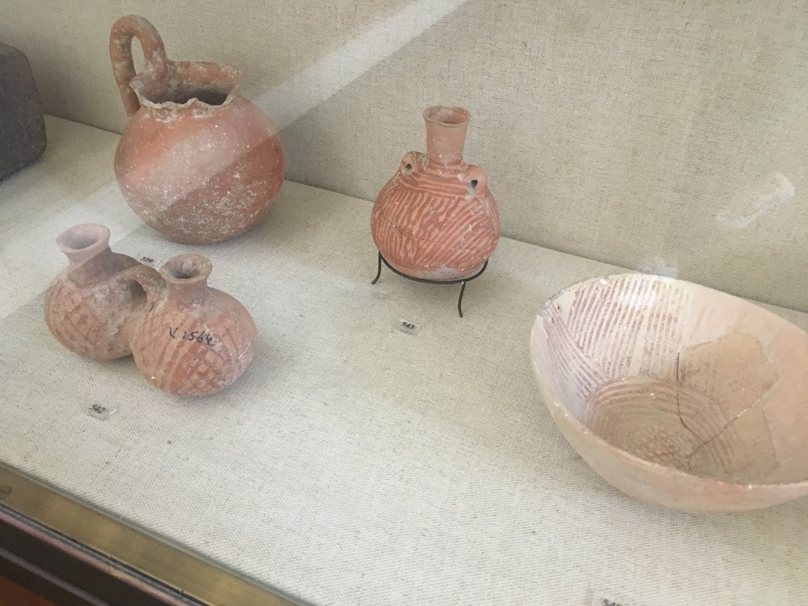
Sophisticated Early Bronze pottery from burial caves

Toward the end of the early Bronze Age the population on and around the mountain began to expand and the archaeology changed. The first break-away's may have lived on the lower valley floor around the Gihon Spring, but most of the growth was supported in caves and rudimentary building constructions, further south along the water line that followed the natural downhill slope of the Kidron valley. In any event there is little evidence of significant population expansion until the Middle Bronze Age from which time the archaeology begins to differentiate.

Ronnie Reich on the upper floor (@645m) of the entrance to
the cave  that was blocked above Warrens Shaft 

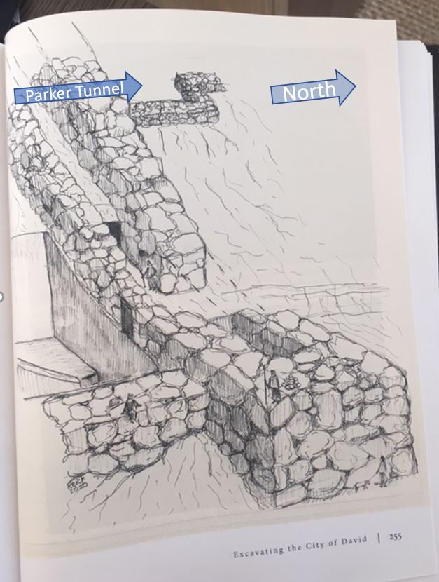
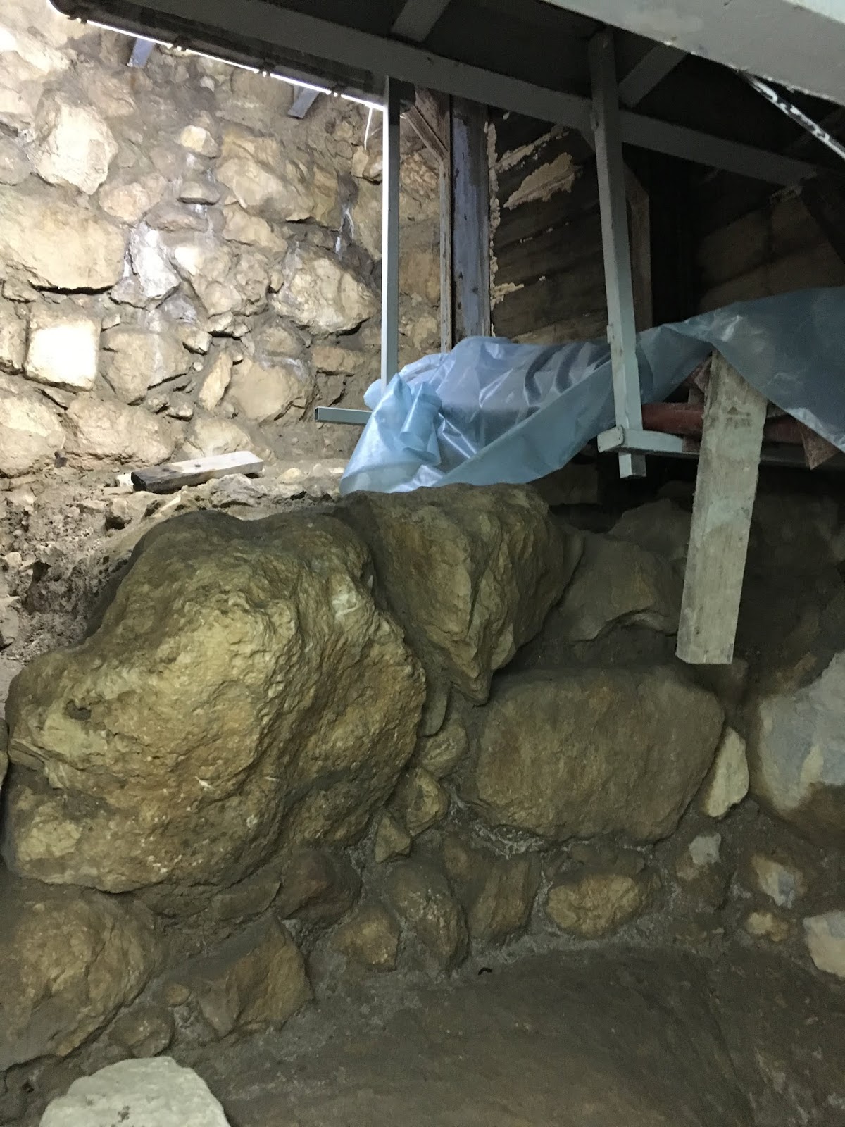
The fortified passage, built between walls 108-109 may have originally been filled, as it was when discovered with Middle Bronze age debris that blocked the cave entrance to support a walkway to a temple complex built of rock-cut-rooms. Alternatively fill was dumped into the passage at a later date in which case the purpose of walls 108-109 was to shield entrance into the cave and Warrens Shaft System. The rock-wall that blocked entrance to the second cave, immediately above Warrens Shaft was built to block entry to the Warrens Shaft System, but not necessarily constructed simultaneous with walls 108 and 109. 


Gray color denotes structures in or below bedrock


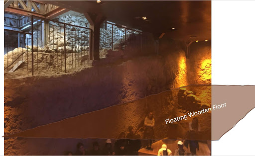
Whether the fortified passage was filled or open, between walls 108-109 the rock-cut-rooms, adjacent to and below Area U (see map above) along passage XIX or via XVIII were the obvious destination. But, why such a massive building scale for the small local population? The temple complex built on the bedrock of the rock-cut-rooms is a significant structure and may answer this question.

Rock-cut-room temple complex

Unlike other cult sites in Israel the features of the rock-cut-rooms are very “Jewish”. By its design, priests would have to face the west, facing toward the altar platform, their backs to the sun while offering sacrifices. The altar platform terminates on the southeast corner (highly specific to Jewish mystical tradition) into a liquids channel, adjacent to a matzevah, oil press, grain press, animal pen and restraints. It's not so unusual that a Middle Bronze Age temple, one that preceded the Jewish nation under Moses could have Jewish characteristics. Religious scholars acknowledge documented practices included in the Bible that predated Moses, including the use of a matzevah, which was specifically disqualified by Moses toward the end of the Late Bronze Age.

A significant event that prompted construction of the rock-cut-room temple complex may explain why it was developed as well as the minimal archaeology on the mountain and areas surrounding the Gihon Spring. The temple complex must have originally been motivated by a spiritual heritage, an event or legendary figure that led to construction especially of the significant Middle Bronze Age walls 108-109. This expanding religious site, as the centerpiece of Mount Moriah during the Early and Middle Bronze Ages may be better explained by a small, priestly or religious residency and their archaeological remnant of this extended period.

On the mountain , the cultural heritage of ancient descendants who predated the Jewish nation would also support the actions of King David, as described in the Bible. After 7 years as king in Hebron, David felt sufficiently compelled to raid the Gihon Spring, enter Zion and move his kingdom to Jerusalem, on Mount Moriah. We are told the raid was via a "tzinor", a narrow pipe likely to have been Warrens Shaft. At that time the Warrens Shaft System was the main tunnel route for water transport into the city. Once David controlled that route, residents and their leaders were beholden to him. By the time David settled, well into  the Iron Age religious worship at the rock-cut-temple may have already been abandoned, bedrock buried by debris and no remaining sign of his ancestral origins on the mountain. The rock-cut-rooms were next seen during the reign of King Hezekiah several hundred years later and are presently the subject of intense excavation by the Israel Antiquity Authority.  


Thursday, August 20, 2020

Good god it was gad!

The annals of ancient civilizations demonstrate the influential power of stellar patterns used to predict good fortune and events that challenged early creation logic. Against ethereal alternatives the constellation logic of occultists, soothsayers and stargazers prevailed. Perhaps the seemingly abstract, often ambiguous and sometime falsified prophetic voice was not as consistent as the suns rising. Strong evidence of astrological cultures are found in archaeology of Mesopotamia and many other regions including in tombs of Egyptian Pharaohs that often tell of a soul journey to the stars and some that become stars. 

According to monotheism the Knower is the Knowledge and the Known, which contradicts that any intermediary, object or living god-figure could ever claim an independent role. Ancient civilizations that credited deities with independence defended the existence of pluralism. These conflicts underpinned the clash of cultures in the fertile crescent from modern Turkey through Egypt. 

Long memory is best preserved in ancient teachings and living, intact cultures that claim a communal continuum. The best long memories are maintained by cultures that posses a rich archaeology, history and anthropological synchronization in laws and customs still evident in the modern continuum.  

The oldest and most intact continuum with a written history, rich archaeology and anthropological synchronicity are the Israelite Hebrews diversely known as Jews. Descendants of Biblical Jacob, also known as Israel they prove a 3500 year continuum. At least this is validated through the paternal lineage of priests who descend from Jacob's son Levi and from whom today's high priestly sect continue to ascend. The continuum by this Levite sect is evident in general communal acceptance and validated in orthodox synagogue practices of modern Jewish people.

The Biblical and archaeological record illustrate the impact of these conflicting ideologies on the unity of the Jewish people. After King David conquered ancient Jerusalem on Mount Moriah, 2900 years ago he proceeded to unify Israel's disparate tribes and locate the altar around which a permanent temple could then be built. By law and intact tradition of its communal continuum the permanent altar had to be built where, 800 years earlier Jacob's father Isaac was bound by his father Abraham and offered as a sacrifice. As much as he tried, David could not locate it.

Then, a series of personal errors and political challenges challenged David's leadership and coincided with a nationwide pandemic. It caused him to repent following a vision of the angel of death standing a top Mount Moriah poised to destroy Jerusalem. Gad, his lower prophet advised David to build a personal altar on land at the foot of his angel of death vision and offer sacrifice to stay the pandemic. He appealed to Israel's tribal leaders to participate. They jointly purchased the 'angel of death' land from the local Jebusite king, then David built his altar and offered sacrifices.

The established written records of the Jewish continuum, that permit the above reconstruction describe a default communal shift that resolved continuum law and established the location where David's son Solomon built the altar and temple. There are no references tat confirm whether the default location agreed by the tribes also agreed with the continuum law that the altar be at the same site Isaac was bound. One generation after King Solomon, his son could not retain Israel's national unity, the nation split, the continuum was permanently altered and the majority turned to an alternative temple and worship.

The word gad in the written Biblical record occurs 67 times. 54 times refer to Jacob's son Gad, his tribe or their tribal land. It means 'good fortune' that originates from his naming at birth. On 13 other instances it relates to Gad the seer or lower prophet of King David. Only once the term was used to identify a god for good fortune and berate those who made 'good fortune' their independent god. 


Tuesday, July 21, 2020

Jerusalem vs. The Sun!

The origins of Christianity and Judaism differ significantly, including by a clergy who faced east to herald the sun or west to obviate it. Orientation in church architecture is toward the altar, the main interior interest is positioned towards the east, the main entrance to the west end. But, Jerusalem's temple architecture was opposite, it opposed the sun rising and biblical history is replete (2 Kings 23:1-25) with sun worshipers who challenged its main point of interest, its Holy Inner Sanctuary positioned toward the west


A recent ~2600 year old City of David, Jerusalem discovery relates the last period in which the horses of the sun gods were destroyed by King Josiah (see video).


Whats the big deal you may ask? Respect or disrespect - not as much about the direction priestly practitioners face, rather the direction their rear ends face! That insult laid waste untold millions of lives over thousands of years and provides a fascinating insight to the origins of Jerusalem's temple culture and subsequent rise of organized religion. 

The discovery of rock-cut-rooms on the east facing, lower slope of Jerusalem's Mount Moriah, in proximity to the Gihon Spring may be Jerusalem's original temple, so called Temple Zero. 

West end features including raised platform for altar

The notable direction of Temple Zero is by the placement of its most important features including matzevah, or standing stone and raised platform, the remnant of its altar toward the west. Priests offering and attending to sacrifices on this altar would have faced west and wine or water poured onto the altar would have run in the liquids channel toward the pit on the east. Facing west obviated glorification of the sun, especially obvious during sunrise worship. 
West to the matzevah

West to the altars' raised platform

Jewish religious practice does not permit the use of any medium or physical depiction as a conduit or substitute to a unified, omnipotent and directly approachable God. This premise dates back prior to the biblical record through establishment of monotheism. The practice transferred from Adam to Noah, to his son Shem known as Malchi-Tzedek (the Righteous King) and finally his descendant Abraham was the first to effect and teach the religious philosophy that was distinguished from the duality of paganism. 

The bible prohibited post-Egyptian Israelite's from using a matzevah to covenant with God. Abraham's grandson Jacob was the last to erect such a stone at Beit El (Bethel) before the prohibition. Approximately 650 years after Jacob (Israel) was exiled to Egypt before King David returned the nation's central administration to Mount Moriah.  

Practically the steep eastern slope is crowd unfriendly. The bedrock to the west rises (as seen by the retainer wall constructed for these excavations) and to the east falls away rapidly (as seen in the people walking up the steep ascent). Yet, by its very layout worship at this site did not pay homage to the sun. So, what was its purpose in context to the site of Solomon's first temple through the Herodian second temple further north on Mount Moriah?


East to the Kidron Valley

From the great work of Israel Antiquities Archaeologist, Ortal Chalaf (standing @2 - middle image above) and Joe Uziel, we are fortunate to glimpse the ten times this space was built, destroyed and rebuilt over hundreds of years from the eighth century BCE to the end of the Iron Age (image @3). This evidences the tension between eagerness of and opposition to occupants that once heralded this sacred place. The biblical record at the end of the Iron Age reveals the fickle character of Jewish Kings who permitted or shunned idol worship in this period and the evidence at this location may directly reflect the Royal attitudes.

Remarkably, the matzevah has withstood the tests of at least 2800 years, from the earliest layer of  construction and destruction above the bedrock. Almost certainly Temple Zeros' rock-cut-rooms precede the first layer built on the bedrock of the image @3, but was it in existence when King David arrived in the 10th century, ~200 years earlier? Most archaeologists agree that part of the fortified passage made up by Wall 109 (left) and Wall 108 (right) (see below) rises to intersect the bedrock ridge of the rock-cut-rooms and it dates to the middle bronze age.  

 Wall 109 and 108 and rock-cut-quarry block passage to Temple Zero (top center)

The fortified passage was a major construction, involving imported, regional labor forces an event that is not recorded in the bible. Despite Joe Uziel carbon dating the north east tower corner, the complex is not considered to be a part of King David's early Iron Age activities. Reference to a pre-Solomon temple is also not mentioned in the 24 books of the bible, therefore a search for Temple Zero dating clarity should be directed to the Bronze Age.

Temple Zero's altar faced the sun, its priests were before the altar, with their backs to the sun. This opposed most, if not all idolatrous practitioners who otherwise would place their deities or human gods in the place of the altar facing the sun and priests before their deity, with their backs to the sun. Alternatively as with Christianity, priests were after (behind) the altar facing east toward the sun. 

Is this the reason Temple Zero was relegated to a rock-cut-quarry (or pool) that blocked ascent from the east and a fortified passage that blocked access from the north-west? It did not celebrate deities or human gods and had no place for priests to practice after the altar, for idol worshiping occupants of ancient Jerusalem it had little use.


The holy center of Jerusalem opposed sun worshipers (Temple Zero bottom left)

In the time before King David whether buried or blocked, even detractors of Temple Zero preserved its sanctity and the matzevah stands as a testament. Perhaps it was concealed so that its spiritual attractiveness to Israelite worshipers of a monotheistic God would be diminished or forgotten and with it their desire to return to The Mountain.


Friday, March 20, 2020

Under The Rock - New Evidence Proof For Temple Zero!

Seldom do senior archaeologists disagree over a hundred years let alone a thousand! A four roomed Bronze Age 'Temple Zero' complex, was discovered and named by Eli Shukron, but his boss, Ronnie Reich openly contradicted him by publishing a video in which he claimed the complex to be a creation of the Iron Age.

Orientation

Lower down the eastern slope under boulders on the bedrock, adjacent to the Gihon Spring was a missing layer of important evidence. Precisely two full missing strata, eight and nine - that can represent up to 1000 years! How did the evidence trapped under a boulder miss out from strata 10 through strata 7? After all it was trapped under the same rock, but nothing from strata eight and nine. How did this missing evidence phenomena occur? 

Sunken Round Chamber (closest) and present day platform suspended in quarry

One answer comes directly from Ronnie Reich who separately explained that a wooden platform was once suspended across the rock-cut-pool or quarry (south of the Gihon Spring) much like the platform on which people are sitting in the image above, only fully extended. The indentation for this platform can still be seen cut into the stone above the heads of the people who are standing.  (also see rendering below) 

Depicted, ancient wooden platform suspended above bedrock


Evidence trapped under the rock

If the ancient suspended platform was maintained in place for the entire period spanning strata eight and nine, evidence from that era would have been prevented from falling to the bedrock. Once the platform was built, during strata 10 it would have locked in strata 10 evidence on the bedrock and no later evidence could fall on top of it. In simple terms strata 10 is around late bronze age - ~3400 years ago, strata 7 late iron age, ~2600 years ago.


From this evidence we can conclude activity existed from the late bronze age. This critical dating is conclusive for the citadel complex built from boulders that most likely originated on the adjacent double wall north of the quarry. Further, it clarifies that water channeled from the Gihon Spring into the deep round chamber (feature of the quarry) was drawn from and processed on the platform for distribution to the people living +50 meters higher up on the mountain plateau. All this has been confirmed by Ronnie Reich.

Gihon Spring Citadel complex
Quarry (south), double wall (west) and guard tower (east) by Ronnie Reich

Since digging the quarry post-dated the deposit of strata 10 evidence, two possibilities emerge: 1) Either the designer hoped the quarry would dam up with water from the Gihon Spring, but never did because it's a geophysical impossibility since the spring is only 1 meter above the base of the Round Chamber, or: 2) The Citadel, double wall and quarry cavity, were the objective of the massive construction effort, if so why?  Its important to recognize that the quarry cavity forever changed the previous natural bedrock slope. Further if the the smaller diameter, round chamber were originally cut into the natural slope the much larger quarried cavity lowered natural access to the round chamber. This required the construction of a wooden platform to conveniently access and process water for distribution.

Perhaps the best clue to the construction objective is not in the quarry or the new water route through the double wall, but at the highest westerly point, at the termination of the double wall at the top of the 35m vertical rise, in a place now known as the Parker Tunnel.

Double Wall Termination
Parker Tunnel
Parker's "cyclopean" clearance

To highlight the steep rise on the eastern slope of Mount Moriah, each color in the image below represents a 5 meter rise above sea level. Ronny Reich's Citadel complex is overlaid on the topography to give you an idea of the impassable access to and from the Parker Tunnel. The highest point, the termination of the double wall abuts the bedrock at an ancient wall section that blocked access to the Parker Tunnel, @670m.


Parker's excavation notes recorded that he removed one of the giant"cyclopean" boulders to improve access, but he failed to discover the complete Temple Zero complex immediately to the south. When Eli Shukron found it in 2011, it strengthened evidence that termination of the double wall, its construction, the quarry cavity and citadel watchtower served a dual purpose: 1) to cut the eastern slope of the mountain and prevent access to the southern end of the Parker Tunnel and the Temple Zero location @670m and 2) to protect the transport of water through the underground passage, now known as Warren's Shaft System.

Residents of Mount Moriah could not have completed this massive construction project without significant help. They relied on allies, imported workers, but what compelled their alliance. Blocking access to Temple Zero may sound a bit far-fetched, but not if you were living their at that time. The new, much enlarged Israel were rising up out of Egypt, nations living on land that was sacred to Jacob knew that Israel would return. If Temple Zero were exposed Israel would have been more compelled to conquer the mountain, like a red flag to a bull. Perhaps the occupants who built this construct knew that when Israel returned they would surely seek it out so they blocked and obfuscated access to Temple Zero!

The evidence trapped under the rock and the quarry proves the quarry construction from the Bronze through the Iron Age. It dates the entire complex on the eastern slope of the Gihon Spring, including Temple Zero to the period around 3400 years ago, around the time Israel rose up out of Egypt and not to the Strata 7 Iron Age.


Thursday, January 23, 2020

Jerusalem's 3800 Year Old Water Bottling Plant!

Between 1923 and 1925 archaeologists MacAlister and Duncan, for the Palestine Exploration Fund and The Daily Telegraph excavated on the Mount of Ophel, Mount Moriah, Jerusalem: Their extensive report included an aerial photo of the area they called the Jebusite City, now known as the City of David. That image (below) was marked by them to illustrates the location of the Fields 5 (north of),7 and 9 they excavated.  To the east, the Gihon Spring in Valley of the Kidron, which they referred to as the Virgins Fountain they wrote: "In fact we have come to the conclusion that there are no Jebusite cisterns at all in the city, but that the Jebusite city was dependent entirely on the Virgins Fountain ([the Gihon Spring] and possibly other springs since dried up) for their water supply."

1925 R.A.F. reconnaissance photo over City of David. 
Of their bedrock discoveries in Fields 5,7 and 9 which rise to between @680-700 meters above sea level they wrote: "We thought, when they were first uncovered that they were cisterns and in the original draft of this report we described them as such. We have now definitely abandoned this theory. There is no trace of a water line on the walls. There is no cup-hollows such as usually exists in the bottom of rock-cut cisterns to catch the last dregs of the water. We now hold that these carefully hewn chambers were tombs of a very early date, presumably belonging to notables of the Jebusite city." Pottery discovered and reported from the grave caves in these Fields dated back well before Biblical Jebusites to neolithic and early bronze ages.

How did life, development and water use evolve from the "very early date" these "notables" were buried on the mountain ridge? We have ample evidence of the embedded bedrock implements that were used for processing food or worship, the cave dwellings carved into rock, quarried bedrock structures and foundations that supported stone houses and walls. However, we must find the main route and the way water was transported from the Gihon Spring or we will not understand how 1000-2000 people began to live on the ridge of the mountain.

Bedrock of eastern slope in context Parker, Reich and Eli Shukron expeditions
Occupation was initially clustered close to or at the level of the Gihon Spring. Moving heavy water from the spring up mountain slope would have required substantial effort. The steep grade of the eastern slope rises 50 vertical meters from the Gihon Spring @634m to Field 9 starting @680m above sea level and within a walking distance of 100 meters from the Kidron Valley floor. Enterprising solutions must have been required to service populations once settlement moved above 650 meters. (Sea level heights are indicated in the image above.) To resolve this problem a King, attributed to the Emorites, Jebusites or one of the seven Canaanite tribes, during the period circa 1800-1700 B.C.E ordered work to expand an east sloping, natural underground tunnel that once ran from around @660m toward the Gihon Spring and Kidron Valley below.

In the video below Ronny Reich explains this underground tunnel now known as a water system or the Warrens Shaft System. There are several important points to note: 1. The iron steps, on which Ronny stands marks the termination of the tunnel and no evidence of steps, at that point has ever been found. Ropes may have hoisted water up the vertical shaft where the iron steps are now built. 2. Ronny indicates the system was used by common people to obtain their daily water, I dispute that, it was used by professional water carriers only. 3. The tunnel route evolved in three stages initially via the natural cave entry-exit to or from the water source immediately north of the double wall fortress and after it was constructed, between the double walls. The final route was more direct through an entry to the tunnel system immediately south of the double walls. These indications support a royal, efficient enterprise that controlled water from the Gihon Spring that had been channeled into the Round Chamber for 'bottling' and distribution.


In a previous article I detailed how the Warrens Shaft System had transformed the sanctity of the ancient bedrock on the lower eastern slope, specifically how it cut the four room worship complex from growing populations on the northern mountain ridge. The water enterprise of the Jeubusites, its capture and continued use by King David, its transformation to industrial zone and food market for the city, by the kings that followed forever changed the ancient character of the eastern slope.


Monday, September 16, 2019

Ancient Jerusalem - A Sacred Burial Site?

From the excavation report by MacAlister and Duncan - Excavations on the Hill of Ophel, Jerusalem 1923-1925: "We thought, when they were first uncovered that they were cisterns and in the original draft of this report we described them as such. We have now definitely abandoned this theory. There is no trace of a water line on the walls. There is no cup-hollows such as usually exists in the bottom of rock-cut cisterns to catch the last dregs of the water. We now hold that these carefully hewn chambers were tombs of a very early date, presumably belonging to notable of the Jebusite city. In fact we have come to the conclusion that there are no Jebusite cisterns at all in the city, but that the Jebusite city was dependent entirely on the Virgins Fountain (and possibly other springs since dried up) for their water supply."

The statement above related to burial sites in Field 5, but also 7 and 9 of the excavation, which is the upper east facing elevation along the north-south ridge of Mount Moriah (west of and between the modern Area G and E). It is testimony to the use of at least some of these areas as cultic worship sites established around sacred burial caves in the early and mid Bronze Age periods.

Presenting my tomb theory to members of the Israel Antiquity Authority

The vigil seen at sacred grave sites in Israel today may resemble an early form of the tradition that continues by devotees who recite psalms and other prayers at the place the spirit of the deceased returns.

Prayer vigil at Joseph's tomb 
As I have previously written, shaft tombs were common in the region during the early through middle Bronze Age.  Arguably Jerusalem's most ancient and important tomb may have existed for 1000 years or more before it was hacked when an Iron Age quarry cut the north-south passage on the lower eastern slope of the mountain. The path between two significant Bronze Age features, the upper floor blocked cave and the lower floor cave house (Parker), that exists either side of the quarry may have been purposely separated in order to prevent ("stop or cancel" - see video) the continuous traditions of occupation and organized worship.


Plan of Gihon excavations
The Rock-cut pool disconnected bidirectional north-south access 
Along the rim of the quarry the slope of the bedrock's south face can be seen below. It is now known that water could not be contained in the quarry because the low degree geophysical slope from the Gihon spring, north of the quarry could never build sufficient hydraulic pressure to raise water into any section of it.

Cut quarry often confused as - upper Gihon Pool
The remnant round chamber (as it is known today) is contained in the bedrock of the rock-cut quarry visible below. It may once have been a much taller shaft connecting the burial chamber at the base to the surface (as illustrated top left of image).

Remnant of shaft to round chamber in rock-cut quarry 
The confirmed discovery of early and mid-bronze burial sites, in vicinity on the eastern slopes of Mount Moriah, as it descends toward the Kidron Valley and Gihon spring offer strong support for the theory that the round chamber in the rock-cut quarry once was a shaft-tomb leading to a sacred burial chamber. Eventually, at its base the abandoned burial chamber was connected to the Gihon Spring source through a series of cut channels.

On the adjacent, north face of the quarry the partly collapsed massive bronze age double wall rises from the east, near the Kidron Valley up the steep bedrock slope to the west. At the top (west), the double wall once connected with the city wall built at the time of King Hezekiah to further and completely block passage from north to south. around 100 years ago Montague Parker cleared sections of the wall to provide passage through a tunnel as seen in the next two images.

Double Wall looking east - quarry to the immediate south.

Top of wall was dismantled by Parker - looking north
(Kevin's gate can be seen in background left).
Before it was dismantled by Parker, the top of the double wall abutted the city wall, which in conjunction with the quarry entirely blocked the north to south passage across the lower section of the east face above the Gihon Spring. In addition to sacred graves, we need to understand the time periods and long-standing motivations to undertake this massive construction.

Drawing (looking to the west) from Ronnie Reich's book
 demonstrates how the double wall, above the
Fortress of Zion and quarry blocked passage.
Parker dismantled the top section of the double wall, that abutted the city wall to obtain access room 3 and 4, (image below) but he never made it to the adjacent rooms 2 and 1, they were discovered in 2011 by Eli Shukron.

Temple Zero complex facing east near the Gihon Spring
If these four rooms comprised a Bronze Age temple, the quarry, double walls and city wall may have been specifically constructed to prevent successive populations from practicing sacred rites in the four rooms. Herein may lie the long-standing negative motivation to construct such significant barriers that surround this important four room feature and prevent its use.

As MacAlister and Duncan suggested in their detailed report the story of the Lame and the Blind at the Fortress of Zion may further explain such long-standing motivations. The fortress refers to the stone construction immediately south of the Gihon Spring, extending west up the steep east face of Mount Moriah.

All city walls depicted in this image
have not been located in archaeology
This Jebusite fortress is referred to in 2 Samuel 5:7-8 and 1 Chronicles 11:5. King David's troops entered, captured and lived in the fortress until they eventually took control of the broader areas and the surrounding populations on the mountain. According to the Biblical accounts, surprisingly the Jebusite King was never forced to vacate Mount Moriah. During King David's 40 year reign at the same location the Jebusite Kings other property rights were upheld.

According to tradition the Lame and the Blind refers to the pacts between Abraham, Isaac and the descendants of Philistine progenitor Avimelech, as inherited by Jacob. These pacts permitted the Jebusites rights to occupy land in this region. King David allegedly broke the 500+ year "Lame and Blind" pact when his troops conquered the fortress and renamed it and the mountain the City of David.

The fortress and walls preceded Iron Age King David, by at least several hundred years. Therefore, the Bronze Age burial sites in the immediate vicinity may have motivated the Fortress, quarry and double wall obfuscation of the Temple Zero complex as a reminder to Israel of their paternal "Lame and Blind" pact with Jebusites. In this context "Lame" refers to Jacob who was lamed during his tussle with his "angel of death" brother Esau while en route back to the matzevah he erected 20 years earlier in the place he named Beit El, on Mount Moriah, the night he experience his famous "Jacob's Ladder" dream. Unlike room 3 of Temple Zero, which was purposefully constructed to retain the bedrock platform in its northwest corner, room 2 was empty until, post construction the perfectly preserved matzevah was located on its bedrock.

The Israel Antiquities Authority have agreed to investigate using geophysical probes and other methods that may reveal how or if it is affixed to bedrock. Regardless, its preservation in rooms that were sealed when discovered in 2011 is nonetheless remarkable.

Matzevah of Jacob on Mount Moriah


Thursday, July 11, 2019

Report from City of David

After living in exile in Egypt for 210 years and after wandering the desert for 38 years, Israel sought to enter the land of its inheritance. To their surprise Amalekites disguised as Canaanites attacked them, Edomites refused them passage, Moabites and Ammonites withheld food or water. All these events took place on Israel's southern approach, along the eastern side of the Jordan river and are recorded for posterity in passages of Chukat (Numbers:20-22) from the Bible.

What inspired these independent nations to collaborate against Israel? In absentia, Israel should not have deserved their collective, ill treatment or designation as enemy of their various states. Yet, they unanimously stood against Israel's attempt to reach its destination. The threat of Israel rising must have been a significant motivating factor that contributed to this coordinated national resistance.

If we use the Bible as a context, Israel's redemption from exile in Egypt must have seemed like the impossible come true. This fledgling nation of 70 had grown to an army of 600,000 men and now their families were amassed along the south eastern boundary of the Jordan River. The daunting prospect should have dampened the conviction of the alliance against Israel, yet each nation stood resolute against them.

This article is not about the war that ensued, during which Israel conquered the land of Moab, Amon and the Amorites east of the Jordan river instead it focuses on the ultimate destination, the mountain that motivated Israel's allied opponents to remain united and intransigent.

Some 300 years after these events, there was good reason King David waited for 7 years, after his inauguration, before he could advance on the mountain from which he would ultimately establish the united kingdom of Israel. The mountain, is ancient Jerusalem's Mount Moriah associated with some of Israel's most significant events during establishment, and post redemption from Egypt. Israel's preamble, as recorded in the Bible and commentaries preserved over multiple millennia include stories of, Adam, MalchiTzedek, Abraham, Isaac, Jacob, Joshua and, David followed by a 1000 year lineage of kings. So, why was conquering the mountain a go-no-go event for David and why did he risk his fragile kingdom to capture it?

To answer that I offer the following pictorial study of the early through late bronze age (4000-3300 years ago) artifacts that preceded King David (3000 years ago) on Mount Moriah.

Inside cave home on the
 lower eastern slope of Mt Moriah

Passage out of cave home,
north to steel steps

Early bronze VIP pottery
discovered by Parker

Connection from top of 
cave home passage to upper ridge


Connection arrives at upper
ridge altar and liquids channel


Upper ridge - bedrock
 and steel cabinet
Standing stone/pillar
or matzevah on upper ridge


Oil press on upper ridge
 (north end)

V-markings on upper ridge
(animal processing - south end)


Double walled fortress of Zion
south of Gihon spring
View from upper ridge into
the double wall fortress of Zion

 More at this interactive map 

By the end of the Middle Bronze Age the massive double wall of the fortress of Zion was built up the steep eastern slope of Mount Moriah. It was an enormously complex feat of architecture and engineering for that time. It could not have been accomplished by the small local population alone. They must have obtained the full support of the alliance and there must have been a deeply rooted reason for allies to dedicate the resources required for its construction. The water of the adjacent Gihon Spring was not directly protected by its construction and could not have served as the reason for it.

The artists rendition of the King Solomon Era, eastern slope of Mt Moriah, demonstrates how the double wall fortress of Zion circa 3300 years ago (400 years before Solomon) may once have cut access across north-south directions on the eastern slope. The city wall, circa 2700 years ago, was  added before the destruction of the first temple.

The ~2700 year old city wall can be seen
in the upper section of this image on top
 of an older wall connected to the bedrock

Connect the blue plastic to piece together
remnant of the southern element of the
 double wall fortress of Zion

Apparently the allied forces opposing Israel did not want Israel to come back to the mountain and particularly this section on the south eastern slope. But, why did King David make sure to conquer this mountain, at this location in order to unify his kingdom?

The area was once known as Luz, Salem previous to that. It was the area that Malchi-Tzedek practiced as high priest, where Abraham tithed to him, where Isaac was offered as a sacrifice and Jacob erected the pillar, standing stone or matzevah. For these reasons Israel's allied enemies were intent on permanently isolating the bedrock temple discovered at this location and they did all they could to ensure the impracticality of its use. They allowed it to be buried under natural ground cover and defended against Israel's attempts to reoccupy the location. By the time King David conquered it, 300 years after Israel's return, the bedrock temple on the upper ridge was out of site, buried deep under ground. These are my opinions, I invite you to form yours!