Translate

Showing posts with label Luz. Show all posts

Friday, April 17, 2026

When God Returns Zion To Its Place!

Zohar (Beshalach 2:55b) teaches that Zion is the psycho-spiritual attribute of Foundation, the Yesod that in reality is activated by separating the inner 'periya' of the Jewish circumcision from the outer 'orla' representing Malchut, Kingdom, Jerusalem, then by folding them over, together they manifest Jewish covenantal reality. The Book of Creation, Sefer Yetzirah relates these to the covenant of holy tongue, language and its use of Hebrew's holy letters, that aspire for pure speech.

The Kedushat Levi explains that this type of "speaking" (speech) was expressed by Joseph The Righteous, Yosef Hatzadik refusal to "suckle" from impure sources (a reference to his struggle in Egypt). The letters of Josef and Zion share the same numerical value or gematria '156' both represent Yesod, the organ of Israel's covenant which Yosef guarded and maintained in purity avoiding foreign, impure influences (both physical and spiritual).

The Lesson: Rav Levi Yitzchak teaches that the mouth, that is destined to "speak to the Shechinah" (Divine Presence) must be guarded against impurity, just as Yosef guarded himself in Egypt.

By following the laws of kashrut as stated in Shemini, Jews sanctify their mouths to ensure they are worthy of connection to God, mirroring Yosef’s righteousness. Immediately prior, also, in Shemini, Nadav and Avihu died brining a foreign fire into the Holy of Holies and later, from Balak the midrash and Zohar describe how their souls were converged into Pinchas who uniquely became elevated to the Priesthood as a Kohen and who was ultimately reincarnated and became The Prophet Eliyahu Tishbi.

Every Passover Jews pour a cup of wine then walk it to their front doors where they call outside for Eliyahu's return, which is thought to be the event that precedes Messianic return (Moshiach). The same Eliyahu is welcomed at every Jewish Circumcision, The Covenant, who comes to spiritually observe the separation of periya and orla of every brit milah.

This perpetual Jewish ritual connecting covenant with speech, Zion with Joseph manifests in the future King David Messianic reality when Eliyahu returns to tell about the imminent realization of Moshiach in the world. This is the time that Zion will be fully revealed and the Shechina, representing God's presence, is restored as the prevailing and dominant feature manifest in reality.

The prophet Isaiah, Yeshayahu states; בשוב ה״ ציון" (52:8)" which literally means "God will return Zion". Commentators debate comparative translations of similar verses, but all other grammar relating to this return include prefix or suffix letters that indicate God will return. However, here God will return Zion, which we can comprehend in the lofty psycho-spiritual realm, but we must also understand it in reality. 

Zion is mentioned first in 2 Samuel 5:7–9 which says: “David captured the stronghold of Zion and renamed it City of David…Whoever would strike the Jebusites, let him go up the water channel (TZiNoR).” The site is the “stronghold of Zion” captured via the water channel.

"Stronghold of Zion" could mean adjacent (nearby) or surrounding Zion, but close in proximity. So, we are left to ponder whether David ever located the physical Zion that the stronghold protected or what may have happened to it?

When David captured the "stronghold of Zion", the Jebusite village was a settlement on the upper ridge on the lower (southern) slope of Mount Moriah immediately above, in line with the spring of En Shemesh, first mentioned in Joshua 15:7 a few hundred years prior. 

However, II_Samuel.5.9 tells us the stronghold was renamed City of David, later 1 Kings 8:1 says the City of David is Zion and much later Isaiah 52.8 says God will return Zion

King David had been anointed seven years prior to his arrival at the Stronghold, so what compelled him to come to this Mount Moriah location, conquer the stronghold and invoke the name Zion? 

As we have already discussed, the ancient psycho-spiritual-reality converging Zion and Jerusalem was already entrenched in indigenous tribal Israelite culture. The name Salem emanated at Abraham tithing Malchi-Tzedek, the High Priest of Salem and later at the binding of Isaac Abraham added the name Yireh to the same site together constituting Yireh-Salem: Jerusalem.

On Davids arrival at the mountain, his coining the word "Zion" declared it as the integral objective of his mission. But, the stronghold was a lesser substitute for a Zion that was not ready to be returned. Instead the City of David became its substitute. Once the first temple had been built Zion began to drift from its anchor and its location on Mount Moriah shifted from the original location by which Jerusalem had once obtained its name.

After the events that established Yireh-Salem Tanach reserved the definite article “HaMakom” (“The Place”) for its Moriah location, which permanently identified it as the altar of Isaac's binding -  Akedah. But, almost 1000 years later, King David made a surprise announcement: “This is the altar for the burnt-offerings of Israel”, it broke the chain and shifted Zion to the mountain summit “on Mount Moriah, where the Lord had appeared to David his father, at the place that David had appointed, on the threshing floor of Ornan the Jebusite.”

Jewish Law and Tradition establish Zion, the inner Foundation and Jerusalem, the outer Kingdom by absolute precision, fixed by Divine designation, tribal boundaries, and physical features that can be verified against text. They are in fact not only places reserved for the psycho-spiritual-realm, their convergence must also, both occupy the same place in the physical realm and when they do, "God will return Zion" to its place! 

Maimonides rules in Mishneh Torah, Hilchot Beit HaBechirah 2:1: “The altar is [to be constructed] in a very precise location, which may never be changed, as it is said: ‘This is the altar for the burnt-offerings of Israel.' This ruling ties Akedah to the incident that caused King David to build an altar at the foot of the Angel of Death that was standing on a threshing floor on the summit of Mount Moriah. Crucially, well before King David, Tanach makes it clear the site of the Akedah altar was a specific, pre-existing altar, not a threshing floor and no apparent association with Zion or Yireh-Salem. 

Walking up to the site of Akeda or the threshing floor can only ever, geo-physically, be made by approaching from the south or east in order to preserve a sense of psycho-spiritual rising up or elevation known as 'aliya-la-regel'. Some 300 years before King David, Joshua’s tribal boundaries fixed Benjamins Southeast corner on the adjacent northern border of tribe Judah. Benjamin was Joseph's brother and as such is also represented by the lower aspect of Foundation - Yesod and that is precisely where the psycho-spiritual connection between Foundation and Kingdom manifests. It is through Benjamin that the connection between David and Joseph becomes permanent.

Joshua 15:7 The boundary ascended from the Valley of Achor to Debir and turned north to Gilgal, facing the Ascent of Adummim that is south of the wadi; from there the boundary continued to the Waters of En-shemesh and ran on to En-rogel.

Joshua 15:8 (Judah’s northern border): “The boundary went up the Valley of the Son of Hinnom to the southern slope of the Jebusite city, that is Jerusalem and climbed to the crest of the mountain west of the Hinnom Valley at its northern end, at the Valley of Rephaim.”

Joshua 18:16 (Benjamin’s southern border): “The border went down to the foot of the mountain that lies before the Valley of the Son of Hinnom, which is in the Valley of Rephaim on the north; it continued down the Valley of Hinnom to the slope of the Jebusite on the south, and descended to En Rogel.”

These verses place the boundary at the southern slope of the Jebusite city (Jerusalem), the Valley of Hinnom, and En Rogel—the exact area of the Gihon Spring (also called En Shemesh) and the eastern slope of Mount Moriah.

The Gemara (*Zevachim* 53b) explicitly adopts these Joshua boundaries, albeit to explain the second temple altar design: “What is the reason that there was no base on the southeast corner of the altar? … Because it was not in the portion of land of the one who tears, i.e., the tribe of Benjamin … The part of the altar in Judah’s portion was the southeast corner of the base, and therefore there was no base on that corner.” 


On the eastern slope of Mount Moriah, directly above the Gihon Spring (En Shemesh) in the City of David, a rock-cut altar platform, carved from bedrock was discovered along with other significant features in a Stone Temple complex. These features align with the texts:

- Bedrock walls enclose the north, west, and south sides; the southeast corner is open—precisely as required by the Joshua boundaries and *Zevachim* 53b.

- It lies adjacent to the ancient TZiNoR water channel between En Shemesh and En Rogel described in 2 Samuel 5:8 and Joshua 18:16.

- Its location on the Judah-Benjamin border fulfills the tribal division codified in Joshua 15 and 18, with the southeast corner intersecting the boundary exactly as mapped in the excavations.

No other site on Mount Moriah combines these elements: the Joshua-defined border coordinates, the TZiNoR water channel, the open southeast corner, the bedrock foundation demanded by Halacha, and the pre-existing “ha-mizbeach” altar identified by Chizkuni.

When Zion and Jerusalem align in the psycho-spiritual and physical realm Joseph's higher Foundation will unite with Benjamin, then Zion will be returned and Kingdom in Jerusalem will rise again, forever!

Wednesday, January 10, 2024

Timeline of Jacob at Jerusalem's Stone Temple


Biblical events and archaeology, on the eastern slope of Mount Moriah are complex.  Here, I constructed this dual timeline, from creation with Gregorian dating.

According to Biblical chronology Jacob's first encounter on Mount Moriah took place in 1573 BCE. Twenty two years later, in 1551 BCE, he returned with his family to Mount Moriah. Some 30 years later Jacob immigrated to Egypt, where his descendants remained for 250 years before they returned to their ancestral land.

The overlapping 10 year construction and use of the water channel (1545-1535 BCE) within the 30 year time of Jacob makes this discovery remarkable particularly because of its exciting context with the rock-cut-temple and matzevah, stone pillar found within the stone temple location. According to the Bible Jacob erected a matzevah at this location (Genesis 35:14). See video explainer.


Part One
Biblical Dating


Part Two
Archaeology


The video weaves the time bound elements of this remarkable discovery at the City of David, Jerusalem.


Monday, July 3, 2023

We Found “The Altar” of Isaac's Akeda!

The verse in Vayera, Genesis 22:9 states "אֶת־הַמִּזְבֵּ֔חַ", (et-ha-mizbei-ach) "the altar", deploying the absolute noun.

וַיָּבֹ֗אוּ אֶֽל־הַמָּקוֹם֮ אֲשֶׁ֣ר אָֽמַר־ל֣וֹ הָאֱלֹהִים֒ וַיִּ֨בֶן שָׁ֤ם אַבְרָהָם֙ אֶת־הַמִּזְבֵּ֔חַ וַֽיַּעֲרֹ֖ךְ אֶת־הָעֵצִ֑ים וַֽיַּעֲקֹד֙ אֶת־יִצְחָ֣ק בְּנ֔וֹ וַיָּ֤שֶׂם אֹתוֹ֙ עַל־הַמִּזְבֵּ֔חַ מִמַּ֖עַל לָעֵצִֽים׃ 

They arrived at the place of which God had told him. Abraham built the altar there; he laid out the wood; he bound his son Isaac; he laid him on the altar, on top of the wood. 

The 13th century commentator Chizkuni states:  'את המזבח', 'the altar'. The Torah wrote: 'the altar' with the prefix letter ה which meant that it was the altar that had previously served such a purpose. According to our tradition, Adam, Abel, Noah and his son, had all offered offerings to G-d on that same altar. 

Why would Abraham have to have built an altar if this verse refers to the altar by absolute noun? Every altar is established on a bedrock foundation, a plinth, which later became requirement under Jewish law. The bedrock plinth supported boulders and stones assembled on it. The plinth or foundation constituted bedrock with boulders together constituting "the altar" on which a sacrifice would be offered. So, where is this altar?

Ronny Reich the longest serving lead archaeologist at Jerusalem's CIty of David opened his recent work "Excavations in the City of David" with a chapter; "A moment in which to be born", by explaining that the spring, east of the City, was never called Gihon, as it is known today, instead the Bible called it En Shemesh (Sun Spring). I completely agree. But, the spring was also classified as a gihon meaning a perennial, intermittent gusher, resembling a pump, sometimes gushing, other times flowing, appropriately and descriptively a gihon (meaning; bursting forth or gushing in Hebrew).

Morning sun shines on En Shemesh

Ronny related En Shemesh to sun worshippers of Jeremiah 8:2 and "horses...of the sun abolished by Josiah" (2 Kings 23:11) and that "perhaps at that time the name En Shemesh (Sun Spring) was abolished" along with idolatry that adored the sun.  Well Ronny, that is entirely possible, but equally unnecessary because the morning sun still shines on that spring, to this very day and its name "En Shemesh" does not necessarily associate it with idolatry.  

Having said all this, Ronny used En Shemesh to reconcile a difficult Biblical passage describing the intersect, critical to the altar, on the northern boundary of tribe Judah with the southern boundary of Benjamin. Why is this important? Because the first and second temples did not comply with this map, but a recently discovered rock-cut-temple and its altar foundation or plinth, on the eastern slope of Mount Moriah, at the compliant location does. Could this be Akeida?

Map from Excavations in the City of David by Ronnie Reich and Eli Shukron


Looking South Kidron Valley


The Gemara (Zevachim 53b) asks: What is the reason that there was no base on the southeast corner of the altar? Rabbi Elazar says: Because it was not in the portion of land of the one who tears, i.e., the tribe of Benjamin, as he is described in the following manner: “Benjamin is a wolf that tears apart; in the morning he devours the prey, and in the evening he divides the spoil” (Genesis 49:27). As Rav Shmuel, son of Rav Yitzḥak, says: The altar would consume, i.e., occupy, one cubit of the portion of Judah. The part of the altar in Judah’s portion was the southeast corner of the base, and therefore there was no base on that corner. 

SE corner of the altar base or plinth.
Dotted line marks the boundary of Judah and Benjamin

In addition, there are numerous important Kabbalistic or mystical concepts and references to the southeast. But, here Ronny Reich conclusively resolved that the only portion of Judah's land that can possibly intersect the southeast corner of the altars' plinth was recently found at the rock-cut-temple, in the City of David and that was used at the time of the patriarchs. Further, the only water system at this site, an essential requirement for frequent temple sacrifices, was last used in 1535 BCE, during Jacob or Israel's last 30 years in the region before their immigration to Egypt. Here Chizkuni is critical because there is no prefix associated with 'the' altar King David designated further up the mountain, on the area of the Temple Mount. 

The 12th Century commentator Rashi, rendered the the altar base:

North (right), this image and the image above

Strikingly, the first and second temple altars on the Temple Mount summit of Mount Moriah did not qualify with the southeast. Four corners of those altars fell entirely in Benjamins territory. No portion of those altars touched Judah's territory as per Joshua's boundaries and Ronny Reich's map above and as stated in the Gamara. Anecdotally, given the geography of ancient Jerusalem an approach from the south or east would exclusively constitute going up to the altar.   

The fundamental and indigenous, tribal right to a permanent temple on tribal land, belonged to Benjamin. Why? Because, Benjamin did not participate in the sale of Joseph. But, it was never made clear to the leaders of tribe Benjamin whether the temple would be built on their southern or northern boundary and that opened grounds for the fiercest tribal competition. Ephraim (Joseph's son) demanded it be on their southern border with northernmost Benjamin, Judah demanded it be on their northern border adjacent to Benjamin's southernmost border. 

After Israel returned from Egypt, during the first 300 years of resettlement, a tragic plague ravaged the nation. To stop it, on Prophet Gad's advice King David repented and built 'an altar', on the summit of Mount Moriah at a location entirely inside Benjamins land, which opposed the ancestral claims of Ephraim. It was close to the border with Judah, but none of its corners fell within Judah's territory. The language difference for 'altar' used in Tanach is startling - מִזְבֵּ֔חַ (miz-bei-ach) without the ה (ha) prefix; not 'the altar', but he built 'an altar':

2 Samuel 24:18
וַיָּבֹא־גָ֥ד אֶל־דָּוִ֖ד בַּיּ֣וֹם הַה֑וּא וַיֹּ֣אמֶר ל֗וֹ עֲלֵה֙ הָקֵ֤ם לַֽיהֹוָה֙ מִזְבֵּ֔חַ בְּגֹ֖רֶן (ארניה) [אֲרַ֥וְנָה] הַיְבֻסִֽי׃ 

Gad came to David the same day and said to him, “Go and set up an altar to the LORD on the threshing floor of Araunah the Jebusite.” 

David's altar was not described using the absolute noun because it was his personal altar, built on a threshing floor where no altar had previously existed. The preceding tragedy had coalesced the nation, all the tribes agreed with David's altar and they contributed to acquisition of the land. David's son Solomon built the First Temple on the summit of Mount Moriah, Jerusalem. 

Searching for the place of the original Akeida altar was abandoned, lost for more than 3500 years. Now that we have found it, we are compelled to build the altar, for the Third Temple, at the location of this bedrock plinth on the boundary between Judah and Benjamin that will once again intersect the original altar's South East corner.


Sunday, December 4, 2022

Jerusalem's Critical Evidence

Matzevah or standing stone found in room2 

Water channel outlets in room 1 and 3


Seldom does a "terminus post quem", the earliest date an item came into existence, and a "terminus ante quem", its last use, perfectly sandwich an in-situ artifact to define its absolute archaeological age. 

In ancient Jerusalem, on Mount Moriah's eastern slope, a crucial study by Weizmann Institute, Tel Aviv University and Israel Antiquities Authority dated evidence in the water channel that served a Bronze Age Temple. Beneath and above a plaster layer, built on top of clay-rich, virgin soil in a natural bedrock cavity the evidence was meticulously documented and carefully gathered. 

Two evidence sites above and below plaster

Directly beneath the plaster (its earliest date), small charcoal flecks were dated separately (sample  9965 and 10293) between 1615–1545 BCE, a "terminus post-quem" for plaster in the channel. At the end of the channel, above the plaster (the last date) several grey and white laminations were found with charred material (sample 9964 and 10292), "ante-quem", understood to represent the channel was last used between 1535 and 1445 BCE. The dates range because the samples were extracted at varying centimeter distances from the plaster, which would indicate earlier or later deposition. 


Short video describing this evidence.

Samples above and closest to the plaster declare that the water channel was only ever used for 10 years (from 1545-1535 BCE), to propel water (by gravity) onto the bedrock floor of two rooms (1 and 3) at the Temple Zero complex immediately below (east of) Area U. The water channel was not used previously nor has it ever been used since. Between the bedrock walls of these rooms animals would have been slaughtered and processed to be offered as a sacrifice. Water was flushed via the channel to clean blood and excrement. Almost 600 years later similar hydraulic systems were engineered and used in the first and second temples further up the mountain.  

 Water Channel in blue -South (Top)

According to established Biblical chronology Jacob and his family arrived on Mount Moriah in 1553 BCE (the same year Benjamin was born) at that time he also assumed the name Israel. 30 years later , in 1523 BCE, they left the region for Egypt where the nation of Israel expanded. After a 250 year exile they arrived back to their homeland, Jacob's birthplace. Based on the strata the precise 10 year use of the drainage channel would overlap Jacobs final 30 years in the region. This finding becomes spectacular because of its exciting context to the Temple Zero location.

Strata of W and V samples closest to plaster.

In the Biblical context of Area U, the rock-cut-rooms of Temple Zero and the Gihon Spring (or En Shemesh), Bible commentators relate events of Adam, Noah, Shem or Melchizedek, Abraham, Isaac, Jacob, Joshua, King David and subsequent kings. Spanning thousands of years, the area on Mount Moriah is also referred by many names including; Salem, Beit El, Yireh (Yireh-Salem), Luz, Tzion, Jebus, City of David and Jerusalem. 


Immediately after King Solomon, Jeroboam mis-directed and split the nation in part by leveraging confusion over Jacob's Beit El. Therefore, his actions and motivations must be understood before one can truly appreciate the magnitude of  discoveries being made at Temple Zero, Jerusalem. The recently discovered, possible City of Ai (associated with Beit El) is located just 1.3 kilometers east of  Temple Zero, resolves Jeroboam's Bethel ruse, 17km north, establishing Jerusalem's Temple Zero the exclusive, common Beit El of Abraham (Genesis 12:1-8, 13:3-4) and Jacob (Genesis 28:11, 35:14).

By aligning the city of Ai and Biblical events with the 100 year overlapping use of the drainage channel, confidence rises that Temple Zero is the location Jacob erected the recently discovered matzevah on which he made a covenant, to which he returned and accepted upon himself the name "Israel".


For the modern nation of Israel to rediscover the original beacon, erected by Jacob on which he accepted the name of their national identity would be nothing short of miraculous, perhaps too much for the archaeological fraternity to acknowledge and extremely challenging for those who believe the binding of Isaac (Akeida) took place on the Temple Mount .


Thursday, February 17, 2022

Hezekiah's Dilemma

Hezekiah's Seal

I was surprised to read a sequence in Talmud, Sanhedrin (95-97) that connects several mysteries related to contraction of land, suspension of the sun's orbit, Jerusalem and a messianic prophecy. 

First in the sequence, Avishai saved King David's life. (95a:8) But, Tanach and midrash inform us that after King David's sinful census 70,000 in Israel's north were killed, the next day, on the summit of Jerusalem's Mount Moriah, when the angel of death was poised to destroy Jerusalem, Avishai was sacrificed to pacify the angel and prevent Jerusalem's destruction. At the foot of the angel of death David offered his personal sacrifice and that site would become the future altar of Jerusalem's first temple. This story is reflected in the 'sword over Jerusalem', words that are said each year at Passover tables the world over.  

Next, Talmud steps the reader back ~500 years to the time Jacob returned and stumbled on 'the place' his fathers prayed (95b:1). By this, midrashim and commentaries we know 'the place' to be the Beit El of Abraham and Jacob, the Akeida (binding) of Isaac, which according to Jewish law will be the place of the future temple altar.

Then, the reader steps forward ~1000 years to learn of Hezekiah's failure to obtain his Messianic designation after Sancheirev attempted to destroy Jerusalem (95b:14). In other places we learn that Hezekiah' failed because he did not immediately attribute the saving of Jerusalem to Divine intervention. Then, Sancheirev was killed by his sons (age 64 - c.681BCE) and Nebuchadnezzar seized control of the Babylonian-Assyrian alliance. Around 100 years after Sancheirev's failed attempt, Nebuchadnezzar dispatched Nebuzaradan and destroyed Jerusalem (96b:4).

Among the brutal detail of Jerusalem's destruction we learn Merodach-Baladan, who preceded Sancheirev, as king of Babylonia, (96a:10) wrote a letter to encourage Hezekiah shortly after he recovered from a near-fatal illness. Young Nebuchadnezzar was the scribe to Merodach-Baladan, but did not draft nor agree with the content of the letter. Hezekiah lived another 15 years (died aged 52 c.687 BCE), around the age of 37 he would have received the letter. 

Finally the Talmud continues a detailed conversation about the Messianic redemption following a sabbatical year (97a:1-10).

In a recent archaeological discovery, the defensive city wall that Hezekiah built to protect Jerusalem from the wrath of Sancheirev's doomed army was uncovered, but it presented an intriguing puzzle about the date of its construction. 

We asked whether the onset of Hezekiah's illness coincided with the city wall construction? If so, the constructors would have commenced during his early 30's, c.707 BCE and discovery of rock-cut-rooms, in the path of the wall construction may have presented a serious dilemma? Carbon dated evidence suggests, for more than five centuries the rock-cut-rooms lay buried below meters of dirt and debris supporting their spontaneous discovery that probably delayed construction until a decision about their treatment was reached. 

Why the dilemma? Well, one thing is for sure, the flimsy matzevah discovered in (2010 by Eli Shukron), in the rock-cut-rooms was preserved by Hezekiah's constructors and remains a declaration of its holy, non-idolatrous status. If not they would certainly have destroyed it, instead they preserved it in soft sand and built the defensive city wall alongside it to the east. We will never know what other  Bronze Age artefacts may have also been discovered at that time (Eli Shukron found some), but we see, from Hezekiah's actions the matzevah was important.

The fact the rock-cut-room temple complex preceded Solomon's temple surely would have prompted Hezekiah to ask why Solomon's temple was built in a different location, further up the mountain? How would Hezekiah, the one designated for messianic status answer that question? Was this 'the place' Jacob stumbled, where he dreamed of a stairway to heaven, set his matzevah (pillar), the place spanning time back to Akeida and beyond to Malchi-Tzedek and the original temple of Jerusalem? 

Walk in Hezekiah's shoes and ponder the depth of his dilemma.


Monday, January 3, 2022

Anceint Jerusalem Walks and Quacks Like a Duck...


The Matzevah of Jacob?

According to carbon dating the rock-cut-rooms on Mount Moriah's east facing slope were not discovered by King David (~3000 years ago) and the matzevah, located in the rooms may have been erected by Jacob (~3600 years ago). After King David, ~2700 years ago, when King Hezekiah discovered the rooms and the matzevah, during his defensive wall construction, he preserved it in soft sand and left it intact against the new city wall.  If he didn't think it were holy, he would have destroyed it along with the other idolatry that was destroyed. Thanks to his decision it was re-discovered in 2010.

The evidence from Weismann and Cambridge confirm organic remnants, found adjacent to the rooms date back 3500-3800 years overlapping with Jacob and accumulating evidence overwhelmingly reenforces the Jacob hypothesis as follows:. 

1. Carbon dating confirmed the rock-cut-room's immediate adjacencies were in use 3500-3800 years ago

2. In situ, organic samples, at a height of 1.2 meters above the bedrock and in compressed earth of a water channel indicate surface dirt would have accumulated for 500 years or more, from 3500 years to 3000 years ago and entirely buried the rock-cut-rooms.

2. Use of a matzevah was banned from the time of Moses (3300 years ago) as recorded in Torah law. King David (3000 years ago) would never have breached Torah law.

3. The altar in the rock-cut-rooms is holy according to Torah law. It faces west, meaning priests would have their backs to the sun, which would be against the principles of east facing sun worship.

4. Hezekiah (2700 years ago) cleared the bedrock artifacts to build the city defensive wall, but he preserved the free-standing matzevah. 

5. During the Middle Bronze Age (MBII = 3800-3500 years ago), Wall 108 and 109 of the fortified passage led people from the lower levels of the eastern slope to the rock-cut-rooms.

6. A simultaneous discovery in 2010, around 1.3 KM east of the rock-cut-rooms could confirm the enigmatic City of Ai.

This accumulating body of evidence make it increasingly difficult to refute the suggestion that the rock-cut-rooms are the location of Jacob's matzevah, Isaac's Akeida and Abrahams Beit El.

It is important to acknowledge the remarkable work of archaeologists and scholars, but its much more important to identify that our discovery of the location King David so desperately sought is part of a much greater awakening. 

More here: 


Monday, November 8, 2021

The Enigma of Ai

 
The Excavation
1.3KM East of City of David

Many have searched for the elusive ancient city of Ai, but no suitable candidate has gained comprehensive support from archaeology and biblical scholars. However, one recently discovered location was buried under by previous theories, not spoken of very much and not identified as a candidate. Uncannily, it was excavated in 2009 simultaneous with, the Middle Bronze Age rock-cut-rooms on the eastern slope of Mount Moriah, 1.3 kilometers west.

East of Beit El, West of Ai

The full hypothesis for original Beit El is strengthened by archeological findings and carbon dating. Details in the video below from the YouTube Channel.


To resolve confusion, the mapped image "East of Beit El, West of Ai" above illustrates the five places, in the Bible that link Bethel and Ai. For the correct archaeological site to be identified, each of these five descriptions must conform to the precise physical location.

a. Abram’s tent: "From there he moved on to the hill east of Bethel and pitched his tent, with Bethel on the west and Ai on the east; and he built there an altar to the Lord and invoked the Lord by name." (Genesis 12:1-8)
          
And he returned by stages from the Negev as far as Bethel, to the place where his tent had been formerly, between Bethel and Ai, the site of the altar that he had built there at first; and there Abram invoked the Lord by name. (Genesis 13:3-4)

b. The conquest of Ai: “Joshua sent men from Jericho to Ai, which lies close to Beth-aven – east of Bethel” (Joshua 7:2). Joshua set an ambush of thirty thousand warriors, followed by a second ambush of five thousand, strategically placed “between Bethel and Ai – west of Ai.” When Joshua and his men feigned retreat, the armies of both cities pursued their Israelite foes, leaving the cities defenseless against the hidden ambush: “Not a man was left in Ai or in Bethel who did not go out after Israel; they left the city open while they pursued Israel” (Joshua 8:17).

c. The 31 Canaanite kings: One of the kings listed is “the king of Ai, near Bethel” (Joshua 12:8).

d. The returnees from exile (in Zerubbabel’s time): ...of those “who returned to Jerusalem and Judah, each to his own city” (Ezra 2:1; Nehemiah 7:6), the returnees are organized by point of origin. There we find: “The men of Bethel and Ai – 223” (Ezra 2:28; in Nehemiah 7:32 the number is given as 123).

e. The final listing of the people of Israel: “The Benjamites: from Geba, Michmash, Aija [Ai] and Bethel and its outlying towns” (Nehemiah 11:31).

In each of the above cases the excavation at Ras al-Amud fits the correct location, time period and scale for the missing city of Ai. 

City of Ai at Ras Al Amud, finally located


In the rectangle original Beit El before the walled city.
Approximately 1.3KM west of Ai
Boundary - Benjamin (north) and Judah (south).


Sunday, November 7, 2021

“Jacob Gave The Name Beit El To Jerusalem”


Click to enlarge

בראשית כ״ח:י״א

(יא) וַיִּפְגַּ֨ע בַּמָּק֜וֹם וַיָּ֤לֶן שָׁם֙ כִּי־בָ֣א הַשֶּׁ֔מֶשׁ וַיִּקַּח֙ מֵאַבְנֵ֣י הַמָּק֔וֹם וַיָּ֖שֶׂם מְרַֽאֲשֹׁתָ֑יו וַיִּשְׁכַּ֖ב בַּמָּק֥וֹם הַהֽוּא׃
Genesis 28:11
(11) He came upon a certain place and stopped there for the night, for the sun had set. Taking one of the stones of that place, he put it under his head and lay down in that place.

Rashi verbatim

THIS IS NONE OTHER THAN THE HOUSE OF GOD —R. Eleazar said in the name of R. José the son of Zimra: “This ladder stood in Beersheba and [the middle of]) its slope reached opposite the Temple” (Genesis Rabbah 69:7). For Beersheba is situated in the South of Judah, Jerusalem in the North of it on the boundary between Judah and Benjamin and Bethel in the North of Benjamin’s territory, on the border between the land of Benjamin and that of the children of Joseph. It follows, therefore, that a ladder whose foot is in Beersheba and whose top is in Bethel has the middle of its slope reaching opposite Jerusalem. 

Now as regards what our Rabbis stated (Chullin 91b) that the Holy One, blessed be He, said, “This righteous man has came to the place where I dwell (i.e., the Temple at Jerusalem, whilst from here it is evident that he had come to Luz) and shall he depart without staying here over night?”, and with regard to what they also said, (Pesachim 88a) “Jacob gave the name Bethel to Jerusalem”, whereas this place which he called Bethel was Luz and not Jerusalem, whence did they learn to make this statement (which implies that Luz is identical with Jerusalem)? 

I say that Mount Moriah was forcibly removed from its locality and came hither (to Luz), and that this is what is meant by the “shrinking” of the ground that is mentioned in the Treatise (Chullin 91b) — that the site of the Temple came towards him (Jacob) as far as Bethel and this too is what is meant by ויפגע במקום, “he lighted upon the place” (i.e., he “met” the place, as two people meet who are moving towards each other; cf. Rashi on Genesis 5:11). Now, since Jacob’s route must have been from Beersheba to Jerusalem and thence to Luz and Haran and consequently when he reached Luz he had passed Jerusalem, if you should ask, “When Jacob passed the Temple why did He not make him stop there?” — If it never entered his mind to pray at the spot where his fathers had prayed should Heaven force him to stop there to do so? Really he had reached as far as Haran as we say in the Chapter גיד הנשה (Chullin 91b), and Scripture itself proves this since it states, “And he went to Haran”. When he arrived at Haran he said, “Is it possible that I have passed the place where my fathers prayed without myself praying there?” He decided to return and got as far as Bethel where the ground "shrank” for him. This Bethel is not the Bethel that is near Ai (cf. Genesis 12:8) but that which is near Jerusalem, and because he said of it, “It shall be the House of God”, he called it Bethel. This, too, is Mount Moriah, where Abraham prayed, and it is also the field in which Isaac offered prayer as it is written, “[Isaac went out] to meditate (i. e., to pray; cf. Genesis 24:63) in the field”.

Thus, too, do we read in the Treatise (Pesachim 88a) in a comment on the verse Micah 4:2: “[O come ye and let us go up] to the mountain of the Lord (i.e. the mountain upon which the Temple is built) and to the house of the God of Jacob”. What particular reason is there for mentioning Jacob? But the text calls the Temple not as Abraham did who called it a mount, and not as Isaac did, who called it a field, but as Jacob did who called it Beth[el]—the House of God. (To here from “This Bethel” is to be found in a certain correct Rashi-text)

Tuesday, October 12, 2021

Beit El, Jerusalem - Did King David Know?

For 10+ years I patiently waited for news, finally it came. Using carbon dating on seeds, twigs and dirt, Regev et al unambiguously showed that the Rock-Cut-Rooms, on the eastern slope of Mount Moriah are sandwiched between two sources of evidence dated to the Middle Bronze Age approximately 3500 and 3800 years ago.

Bronze Age Rock-Cut-Rooms

This is important because all archaeological evidence on the bedrock of these rooms was removed in the Iron Age II, around 2600 years ago when builders for King Hezekiah constructed the recently discovered eastern city wall (W20005 - W20021). Based on this evidence, before the rooms were first uncovered 2600 years ago they lay buried, out of use for some 900 years. No evidence of this time-frame showed up in the carbon dating report. 

Area U and Rock-cut Rooms
 (V. Essman and O. Rose)
Approximate evidence locations marked in red.

You following this? These rooms were in use up till 3500 years ago, then they stopped being used for 900 years, then 2600 years ago they were discovered, uncovered and immediately buried, finally they were re-discovered and uncovered again in 2011. 

East-side evidence samples

West-side evidence samples

Stunningly, the flimsy matzevah at the west end of room 4 (Area U map above) was intact as far back as 3600 years ago, the time of biblical Jacob. This perfectly fits the time-frame of evidence discovered on both sides of the rock-cut-rooms. Further, as the evidence stretches back to 3700 or 3800 years it suggests the rooms were actively in use at that time.

Matzevah (Pillar) of Jacob?


Eli Shukron, the archaeologist who excavated these rooms is unequivocal, this is the first temple that ever existed on Mount Moriah, a thousand years before the First Temple of King Solomon. If this is the matzevah of Jacob (Genesis 28:18, 28:22, 31:13, 31:45, 35:14, 35:20), then this is also the Beit El where Abraham built an altar, tithed to Malchi-Tzedek and offered his son, Isaac. Could it be?


Context to slope of original passage (Parker XVIII)
between Gihon Spring and rock-cut-rooms


Tuesday, August 10, 2021

Jerusalem Archaeology A Biblical Narrative?

Jerusalem's defensive wall on the steep eastern slope

The late first temple city wall, discovered on the lower eastern slope of Mount Moriah, exposed the reason why after 1000 dormant years the Bronze Age underground passage - Warrens Shaft System (WSS) was revived to deliver water inside the city wall to prolong its siege defense against Assyrians and Babylonian enemies. 

https://www.youtube.com/watch?v=Z5Wqhf_8itA 

The mountain city's natural water source was the Gihon Spring, in the eastern escarpment where water exited into a cave just above the valley floor. For the first Bronze Age residents, living on the upper ridge, moving water 60 vertical meters up the escarpment was a major daily undertaking. Back then, supply was regulated by the local kings' whose water carriers would haul water sacks up the escarpment to meet the growing demand further up the ridge.

The east, west and south escarpments, on lower Mount Moriah fall sharply into surrounding valleys that provided a naturally defensive barrier against enemy attack. From the north, on the summit, distant movements could be clearly observed to prepare and repel hostilities. The upper flats, on the lower section of Mount Moriah was ideal to establish a small village and protect its residents, but water presented a major challenge.

Bronze Age occupants had a limited population size, but archaeology for that period suggests more than just local residents helped to construct a secure water carriage system. According to the Hebrew Bible Mount Moriah contained indigenous artifacts that Israelites, after Jacob and 250 years of exile, would have been intent to reclaim along with their inherited land. To improve water security and possibly dissuade an Israelite attack, the residents must have obtained regional labor support from regional allies in order to massively excavate the bedrock of the mountain.

Four significant constructions must be understood in order to interpret ancient events on the mountain and the motivation for theses constructions:

1. The 'Warren's Shaft System' (WSS) - a man-made tunnel rising through the mountain that permitted cool, efficient and protected passage to water carriers. Water was carried from the spring, hauled up to lower level dwellings at the uppermost exit of the system and further up to the city's mountain ridge (a ~60m vertical rise from the water).  

2. Double walls - 'W108/W109' were built, east-west up the escarpment using +1 ton boulders carried up a ~30 degree grade and precisely placed to build the staggered walls that stretch ~50 meters uphill at a height of 6-10m. Such a substantial construction required more labor force than the residential capacity of the upper city.

3. The 'Rock-cut Feature' (RCF) - a large quarry, south of W109 left a gaping wound in the bedrock and cut convenient access between Area U's Rock-Cut-Rooms, on the higher slope of the eastern escarpment and the Gihon water source below.


4. The 'Rock-Cut-Rooms' (RCR) - a temple complex of 4 rooms each with a feature dedicated to worship. They include (from north to south) an olive press for pure oil, raised altar platform and liquids channel, matzevah or anointing-pillar and room for slaughtering and processing animal sacrifices. 


Ongoing debate about the date of these features leads to consensus that some or all elements, of each feature converge on periods of the Bronze Age, which is sufficient context for this article. 


The time-layered system of channels, walls, boulevards, ridges and passages secured water supply for residents who had moved from the valley floor to the mountain ridge. It also served the franchise of the local king. 

During the Bronze and early Iron Age produce in the Kidron Valley was grown using the constant flow of water from Channel I or II. At or around the Gihon Spring produce was processed, traded and distributed. There produce and water filled leather sacks would have been loaded on donkey's that traversed up the escarpment into the city. Eventually a walkway and donkey pathway (see image below) eased the 35+ degree climb ~60 vertical meters up the eastern slope. Food trade from other cities, including the coast may also have arrived from the north and west, along convenient routes to the Kidron Valley.  

South to the Kidron Valley - winding walkway and donkey path (green)
built on terraces (foreground) and Kings Garden (background).

Terraces supporting pathway
 looking north

When attacked the terraced path became exposed and water transportation retreated underground to the excavated WSS. Water carriers would carry water sacks through its underground tunnel and haul them up its vertical shaft to a height ~40m above the Gihon Spring, more than halfway to the top of the donkey trail. At that height, out of harms way carriers would exit a narrow tunnel and carry water the rest of the way into the city.

A natural cave, dated to paleolithic and chalcolithic periods was the original entrance to natural caustic WSS formation. The cave (pictured below), just west of Building 2482 was eventually sealed with a wall, most likely when W108 and 109 were constructed to further secure access to the expanded WSS. The floor of the cave eventually collapsed. Interestingly a recent finding confirmed a massive earthquake late in the Iron Age, which may have been the cause of the floor collapse. 

Archaeologist Ronny Reich inside
the sealed cave leading into WSS to his right

The elevated city provided defensive advantage, especially for prolonged sieges that typically surrounded a city or attacked the water and produce supply line to starve its population and flush them out. For Bronze Age Jerusalem that supply line was at or around the Gihon Spring, the route up the eastern escarpment and the exposed entry to the city from the north. Any enemy force that could prevent food supply would essentially starve the city except for the life-line of water via WSS.

The remnant of the recently discovered late Iron Age wall, built by Hezekiah to stave off  the Assyrian threat was constructed on a line that entirely ran over the RCR's. Archaeologists validated this 200 meters stretch of wall, on the eastern escarpment as Jerusalem's only defensive city wall, none has been discovered on the west. 

Under the wall, on the RCR bedrock of room 2 (see RCR image above) a matzevah (discovered by Eli Shukron 2009) had been entirely preserved in soft sand by the constructors of the wall. The matzevah is the modern City of David's largest, in-situ, intact artifact that has survived earthquake and destruction, because the wall surrounded and protected it. This is strong indication that the King, who constructed the wall, most likely Hezekiah ordered preservation of the matzevah because it reflected his compatible belief in line with that of Azariah, the High Priest and Isaiah, the prophet of the nation at that time. 

The RCR's form a temple complex that includes a sacrificial altar platform at the west end. Priests offering a sacrifice on the altar, that once stood on the platform, had to turn their backs to the sun an unlikely orientation for sun god worshippers, but consistent with practices of monotheistic tradition preceding and incorporated by Judaism. Further, bored into the leading edge of the north wall rock-face, in the room 1 (with V markings in the floor) small animals were tethered. This is evidenced by the low bedrock pass-through-loop that signifies more frequent sacrifice of small animals. According to Jewish law, animals offered for sacrifice must be blemish free and more than 8 days old, naturally younger animals were certain to remain blemish free.  

Low animal tether
 looped in bedrock edge
Close up of low animal
 tether ~25cm above ground

None of the indications in the RCR bedrock inform of its earliest use. However, if this temple complex was indeed used by priests who practiced what would become Jewish custom, then the matzevah is problematic because the Jewish Bible prohibited such use. This can be seen in the words of Deuteronomy 16 below:

21 לֹֽא־תִטַּ֥ע לְךָ֛ אֲשֵׁרָ֖ה כׇּל־עֵ֑ץ אֵ֗צֶל מִזְבַּ֛ח יְהֹוָ֥ה אֱלֹהֶ֖יךָ אֲשֶׁ֥ר תַּעֲשֶׂה־לָּֽךְ׃
You shall not set up a sacred post—any kind of pole beside the altar of the LORD your God that you may make—
22 וְלֹֽא־תָקִ֥ים לְךָ֖ מַצֵּבָ֑ה אֲשֶׁ֥ר שָׂנֵ֖א יְהֹוָ֥ה אֱלֹהֶֽיךָ׃         
or erect a stone pillar (matzevah); for such the LORD your God detests.

However, in an apparent contradiction (Genesis 28:18-22), some 270 years before Biblical laws were collectively accepted by the Israelite nation, Jacob erected and anointed a matzevah to mark his covenant. Naturally the question must be asked; whether a matzevah at this compatibly Jewish, cultic RCR temple complex should indicate an early use based solely on this Biblical prohibition from the end of the Middle Bronze Age?

The original path from water to RCR's was discovered and mapped by Parker-Vincent, but the east end of passage XVIII (see below) had been quarried, disconnecting it from or to the lower section of bedrock. Topology of in-tact bedrock, north and south suggests XVIII would have sloped similarly. Thus, we can conclude that before the Rock-Cut-Feature (RCF) was quarried and emptied, its once untouched bedrock provided uninterrupted egress to and from the Gihon Spring or steps to the Round Chamber and Channel II filled it to a maximum depth of around 1m.

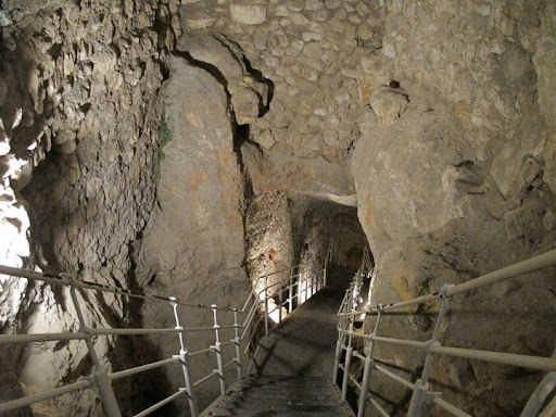
Visitors climb up XVIII to RCR's
the down path leads to water

Map inserted below for convenient reference. 

Height's shown are above sea level

The Bronze Age consensus for W108-W109 construction and presumption that the RCF was the quarry for these massive walls suggests RCF was in-tact until at least these constructions. Therefore, when passage XVIII collapsed or was cut, at its eastern end temple worship on or at the RCR's ceased because once W108-W109 and Wall 3 were constructed access along passage XIX was also blocked. The combination of these terminated passages sealed the fate for any practical future use of RCR's as a temple for worship.

Archaeological evidence suggests the Bronze Age population averaged no more than 800 people, and Late Bronze Age Jerusalem appears to be even smaller. At a maximum the population would have been around 1250 people living on the ridge of Mount Moriah. It's hard to imagine, given the massive scale of these complex constructions that such a small population could have independently supported these undertakings. Further, limited Late Bronze Age evidence suggests the population diminished, perhaps after initial construction was completed. 

The most intriguing and complete evidence from the Late Bronze Age, found in the Amarna letters suggests Egypt's hand in the affairs of 'Urusalim', which prompted Steiner to write in 2003 (abridged):

“Realizing that Urusalim from the Amarna letters must be associated with Jerusalem, I began to read  carefully and discovered another possibility that might account for the lack of archaeological evidence from the fourteenth century. There is no reference to the city itself, nor to its walls or its strong gates. Maybe Urusalim was not a city or large town at all. Maybe we should interpret the “lands of Urusalim” as a royal dominion of the pharaoh, with Abdi-heba as his steward, who lived in a fortified house somewhere near the spring.” 

Perhaps we are left to imagine that Canaanite or Jebusite anxiety, after Israel departed Egypt prompted pharaoh to transform the landscape of the Gihon spring. W108-109 divided the eastern slope, secured entry to WSS and with Wall 3 cut access via XIX to RCR's. To add insult the pharaoh cut the ancient access passage via XVIII and the RCF left a gaping, impassable hole in the bedrock.

The layered time context of the archaeological evidence paints a picture of cave dwellers, early farmers, community, cultic practice, organized supply, defensive activity, and centralized authority. Leading to the end of the Middle Bronze Age's sophisticated construction, bedrock transformation and population expansion. Then, in the Late Bronze Age population downsizing, limited advancement and vassal  acknowledgement until the arrival of the Iron Age when renovation, expansion and development into the City of David recommence with vigor.  

If Israel had become Egypt's spiritual nemesis, transformation of the Gihon Spring had the desired effect. After returning from their 250 year exile in Egypt Israel were kept out of Jerusalem for more than 300 years, until the Iron Age. By then the RCR temple was most likely buried and unknown to the mountain residents and certainly to the generations of Israelites. By the time King David conquered the tower of Zion, the spring citadel and captured the defensive water supply tzinor or "pipe" (WSS) the RCR temple was long forgotten. Perhaps The constructor's of Hezekiah's terminal Iron Age wall were the first, in more than 1000 years to reveal the ancient bedrock RCR temple that pre-dated the Jewish religion on the eastern face of Mount Moriah.